MyTopo
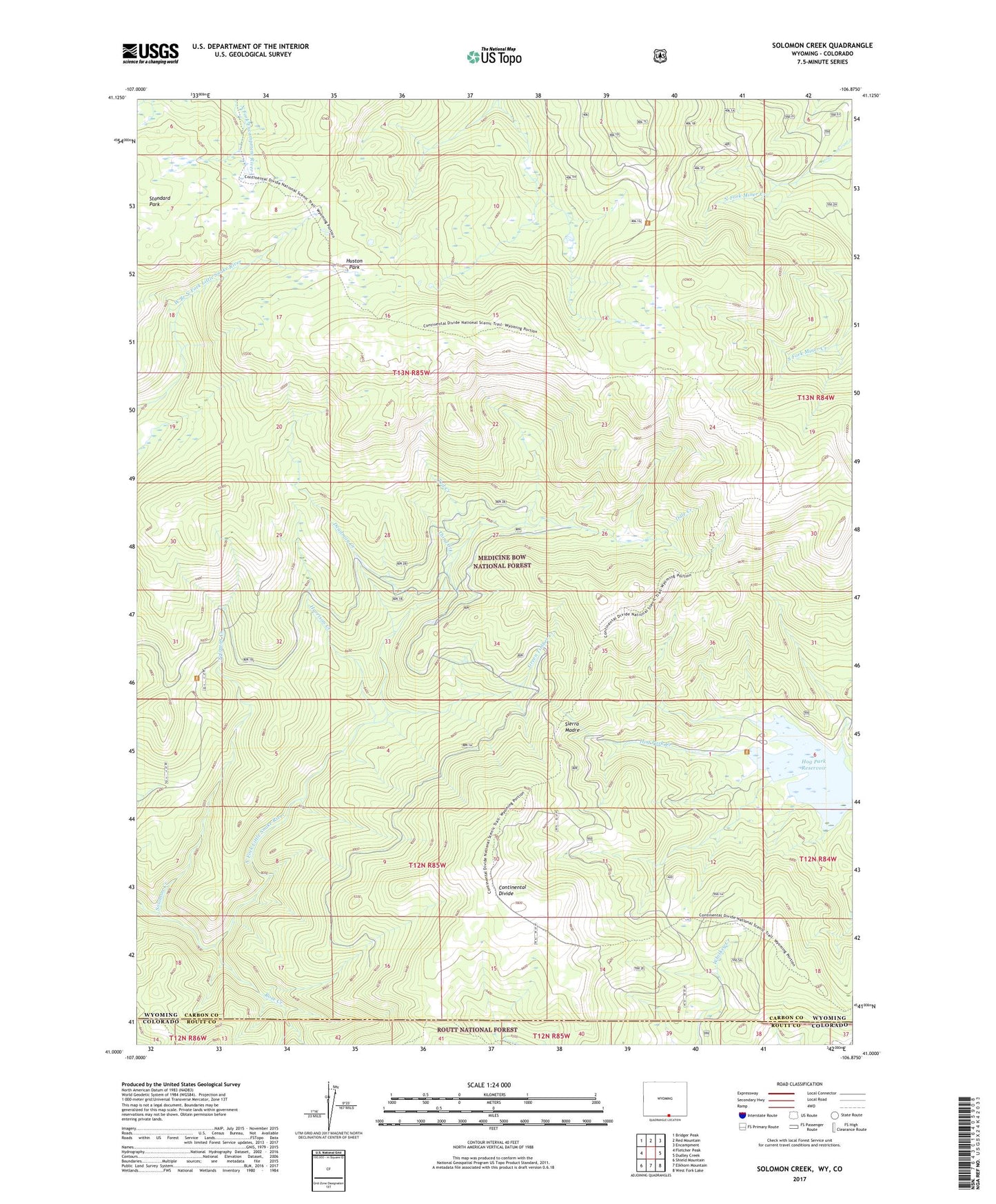
Solomon Creek Wyoming US Topo Map
Couldn't load pickup availability
Also explore the Solomon Creek Forest Service Topo of this same quad for updated USFS data
2021 topographic map quadrangle Solomon Creek in the state of Wyoming. Scale: 1:24000. Based on the newly updated USGS 7.5' US Topo map series, this map is in the following counties: Carbon, Routt. The map contains contour data, water features, and other items you are used to seeing on USGS maps, but also has updated roads and other features. This is the next generation of topographic maps. Printed on high-quality waterproof paper with UV fade-resistant inks.
Quads adjacent to this one:
West: Fletcher Peak
Northwest: Bridger Peak
North: Red Mountain
Northeast: Encampment
East: Dudley Creek
Southeast: West Fork Lake
South: Elkhorn Mountain
Southwest: Shield Mountain
This map covers the same area as the classic USGS quad with code o41106a8.
Contains the following named places: Century Group Two Prospect, Dale Creek, Deadman Creek, Elkhorn Stock Driveway, Green Mountain, Green Timber Creek, Harrison Creek, Hog Park, Hog Park Reservoir, Huston Park, Huston Park Wilderness, Itmay Mine, Robinson Creek, Rose Creek, Solomon Creek, Solomon Creek Mine, Ted Creek, Third Creek, Verde Mine