MyTopo
Wetherill Mesa Colorado US Topo Map
Couldn't load pickup availability
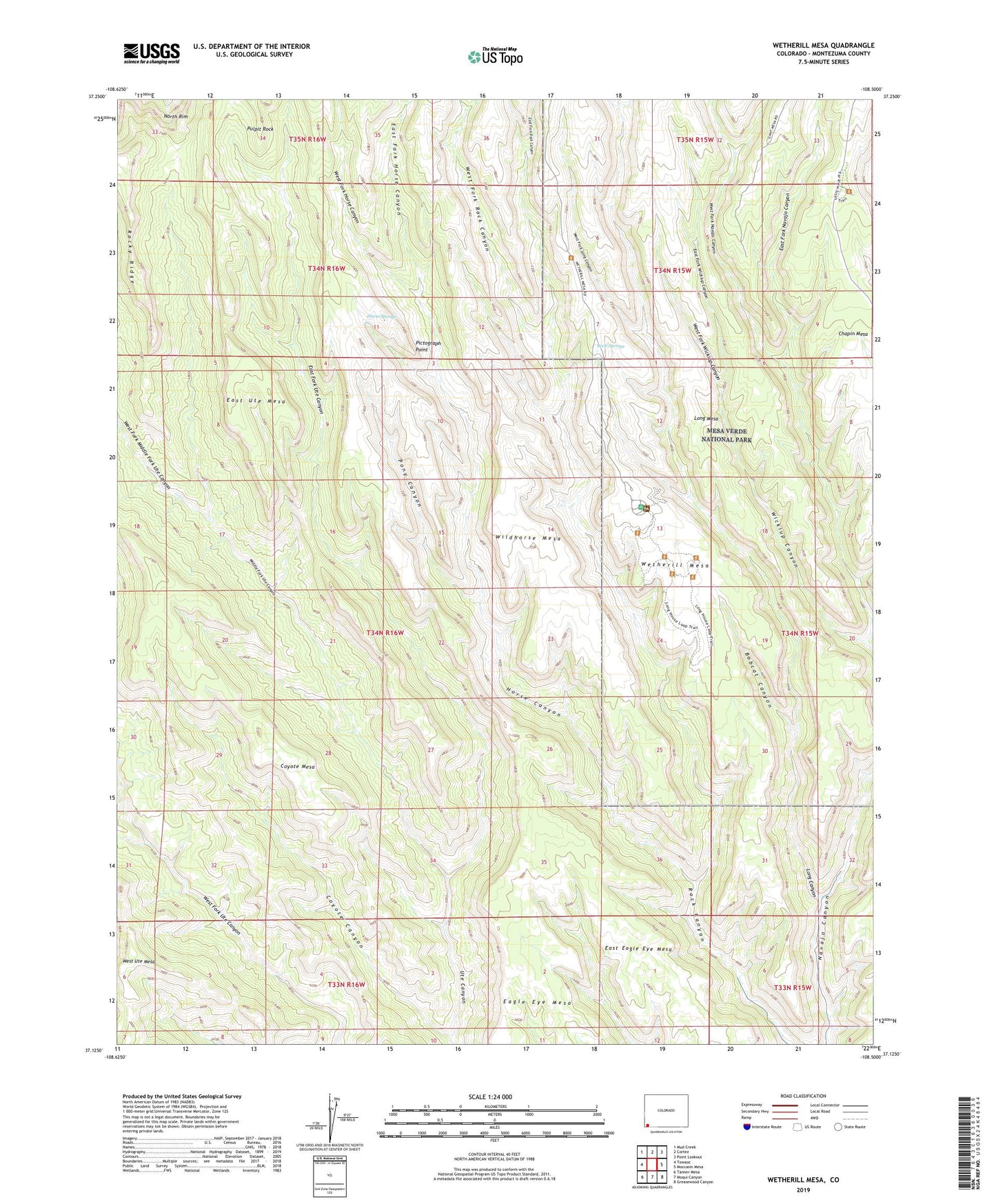
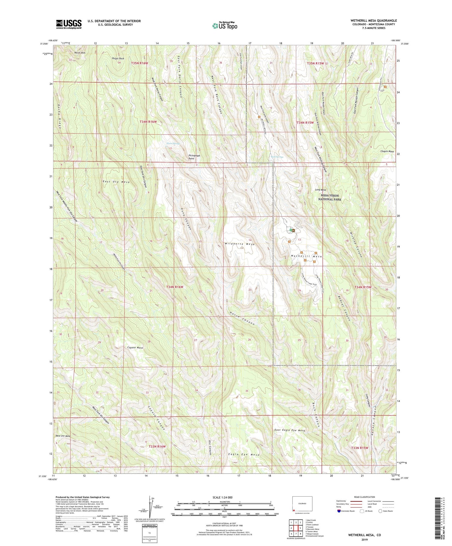
2022 topographic map quadrangle Wetherill Mesa in the state of Colorado. Scale: 1:24000. Based on the newly updated USGS 7.5' US Topo map series, this map is in the following counties: Montezuma. The map contains contour data, water features, and other items you are used to seeing on USGS maps, but also has updated roads and other features. This is the next generation of topographic maps. Printed on high-quality waterproof paper with UV fade-resistant inks.
Quads adjacent to this one:
West: Towaoc
Northwest: Mud Creek
North: Cortez
Northeast: Point Lookout
East: Moccasin Mesa
Southeast: Greasewood Canyon
South: Moqui Canyon
Southwest: Tanner Mesa
This map covers the same area as the classic USGS quad with code o37108b5.
Contains the following named places: Badger House Community, Bobcat Canyon, Coyote Canyon, Coyote Mesa, Double House, Eagle Eye Mesa, East Eagle Eye Mesa, East Fork Horse Canyon, East Fork Navajo Canyon, East Fork Rock Canyon, East Fork Ute Canyon, East Fork Wickiup Canyon, East Ute Mesa, Echo House, Far View Group, Far View House, Horse Canyon, Horse Springs, Inaccessible House, Jackson Mine, Jug House, Kodak House, Kodak House Overlook, Long Canyon, Long House, Long House Overlook, Mesa Verde, Mesa Verde Heliport, Mesa Verde Mine, Middle Fork Ute Canyon, Mug House, Nordenskiolds Site 16, One Clan House, Pictograph Point, Pinyon Pack Trail, Pony Canyon, Pulpit Rock, Rock Springs, Rock Springs Trail, Rocky Ridge, Spring House, Step House, Trail Cross Trail, Ute Springs Trail, Ute Trail, West Fork Horse Canyon, West Fork Long Canyon, West Fork Middle Fork Ute Canyon, West Fork Navajo Canyon, West Fork Rock Canyon, West Fork Wickiup Canyon, West Ute Mesa, Wetherill Mesa, Wickiup Canyon, Wildhorse Mesa, ZIP Code: 81334