
MyTopo
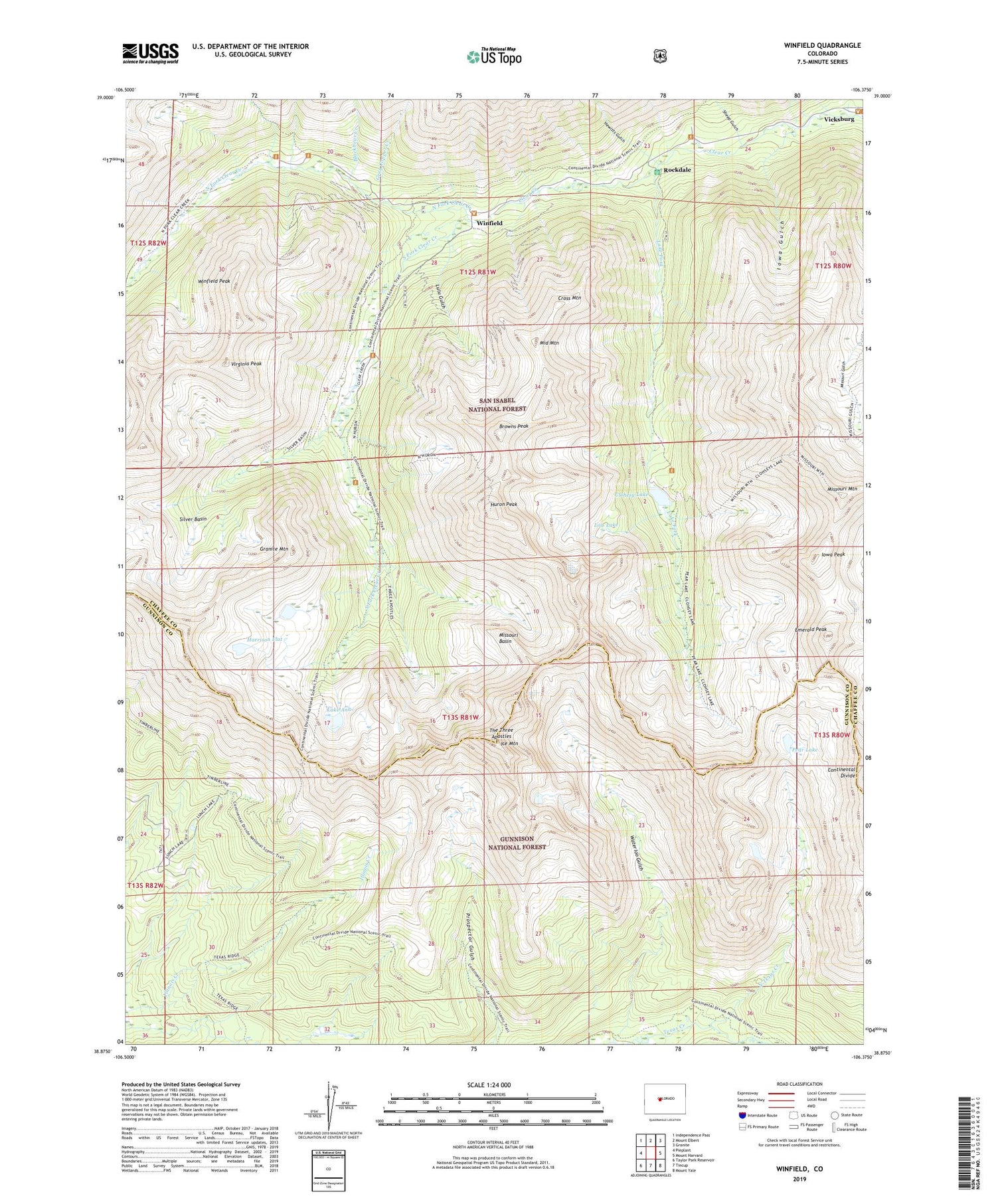
Winfield Colorado US Topo Map
Couldn't load pickup availability
Also explore the Winfield Forest Service Topo of this same quad for updated USFS data
2022 topographic map quadrangle Winfield in the state of Colorado. Scale: 1:24000. Based on the newly updated USGS 7.5' US Topo map series, this map is in the following counties: Chaffee, Gunnison. The map contains contour data, water features, and other items you are used to seeing on USGS maps, but also has updated roads and other features. This is the next generation of topographic maps. Printed on high-quality waterproof paper with UV fade-resistant inks.
Quads adjacent to this one:
West: Pieplant
Northwest: Independence Pass
North: Mount Elbert
Northeast: Granite
East: Mount Harvard
Southeast: Mount Yale
South: Tincup
Southwest: Taylor Park Reservoir
This map covers the same area as the classic USGS quad with code o38106h4.
Contains the following named places: Banker Mine, Blackbear Creek, Browns Peak, Clohesy Lake, Collegiate Peaks Wilderness, Cross Mountain, Emerald Peak, Fortune Mine, Granite Mountain, Grey Copper Creek, Hamilton, Harrison Flat, Hewitts Gulch, Huron Peak, Ice Mountain, Iowa Gulch, Iowa Peak, Lake Ann, Lake Fork, Last Dollar Mine, Little Guy Mine, Lois Lake, Lulu Gulch, Middle Mountain, Middle Mountain Mine, Mike Rabbit Mine, Missouri Basin, Missouri Mountain, North Fork Clear Creek, North Texas Creek, Pear Lake, Rockdale, Sheep Gulch, Silver Basin, South Fork Clear Creek, Swiss Boy Dump Mine, Tasmania Mine, The Three Apostles, Vicksburg, Virginia Peak, Waterloo Gulch, Winfield, Winfield Peak, ZIP Code: 81211


