
MyTopo
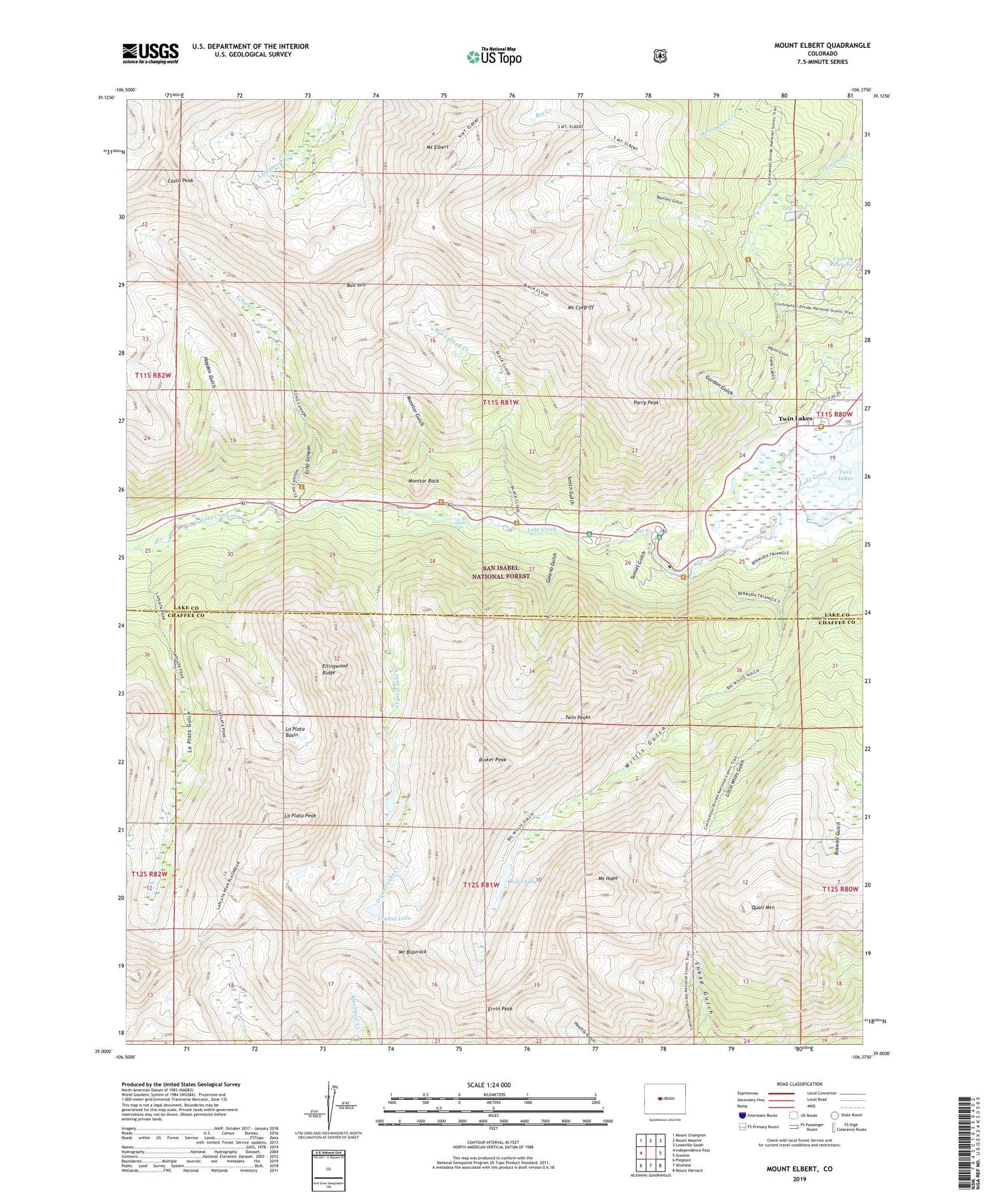
Mount Elbert Colorado US Topo Map
Couldn't load pickup availability
Also explore the Mount Elbert Forest Service Topo of this same quad for updated USFS data
2022 topographic map quadrangle Mount Elbert in the state of Colorado. Scale: 1:24000. Based on the newly updated USGS 7.5' US Topo map series, this map is in the following counties: Lake, Chaffee. The map contains contour data, water features, and other items you are used to seeing on USGS maps, but also has updated roads and other features. This is the next generation of topographic maps. Printed on high-quality waterproof paper with UV fade-resistant inks.
Quads adjacent to this one:
West: Independence Pass
Northwest: Mount Champion
North: Mount Massive
Northeast: Leadville South
East: Granite
Southeast: Mount Harvard
South: Winfield
Southwest: Pieplant
This map covers the same area as the classic USGS quad with code o39106a4.
Contains the following named places: Arlington Ditch, Bartlett Mine, Bengal Tiger Mine, Black Cloud Creek, Boswell Gulch, Bull Hill, Casco Peak, Cozart Dam, Cozart Reservoir, Crystal Lake, Crystal Lake Creek, Dayton Gulch, Echo Canyon, Echo Creek, Edna May Mine, Ellingwood Ridge, Ervin Peak, Fidelity Mine, Galena Gulch, Golden Fleece Mine, Gordon Gulch, Gordon Mine, Hayden Gulch, Helen H Cochran Mine, Iron Mike Mine, Kosmon Mine, La Plata Basin, La Plata Gulch, La Plata Peak, Last Chance Mine, Lily Pond, Little Joe Mine, Little Willis Gulch, Main Range Trail, Monitor Gulch, Monitor Rock, Mount Blaurock, Mount Cosgriff, Mount Elbert, Mount Elbert Trail, Mount Hope, North Fork Lake Creek, Parry Peak, Parry Peak Campground, Practical Gold Mining Mine, Quail Mountain, Rinker Peak, Rocky Point Mine, Sawatch Range, Smith Gulch, Snyder Falls, Sunset Gulch, Sunset Mine, Twin Lakes, Twin Peaks, Twin Peaks Campground, Vesuvius Mine, White Star Mine, Willis Gulch, Willis Lake, ZIP Code: 81251


