
MyTopo
Wrights Reservoir Colorado US Topo Map
Couldn't load pickup availability
Also explore the Wrights Reservoir Forest Service Topo of this same quad for updated USFS data
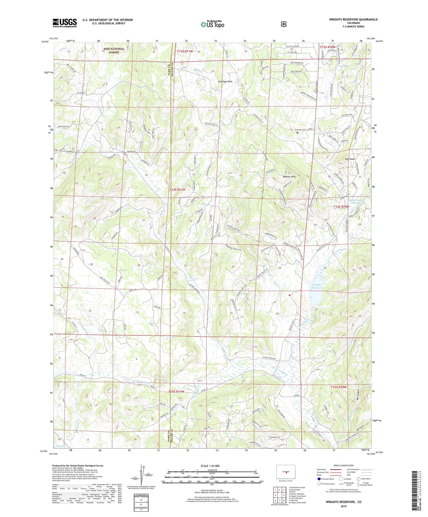
2022 topographic map quadrangle Wrights Reservoir in the state of Colorado. Scale: 1:24000. Based on the newly updated USGS 7.5' US Topo map series, this map is in the following counties: Teller, Park. The map contains contour data, water features, and other items you are used to seeing on USGS maps, but also has updated roads and other features. This is the next generation of topographic maps. Printed on high-quality waterproof paper with UV fade-resistant inks.
Quads adjacent to this one:
West: Witcher Mountain
Northwest: Elevenmile Canyon
North: Lake George
Northeast: Divide
East: Cripple Creek North
Southeast: Cripple Creek South
South: High Park
Southwest: Cover Mountain
This map covers the same area as the classic USGS quad with code o38105g3.
Contains the following named places: Antelope Park, B Lazy M Ranch, Barnard Creek, Bearing Tree, Beasley Hills, Beltz Number 2 Dam, Beltz Number 2 Reservoir, Box Canyon, Cobb Creek, Cottonwood Creek, Daggett Creek, Dog Head, Dry Creek, Four Mile Emergency Services, Four Mile Fire Protection District Station 1, Fourmile Cemetery, Hay Creek, Jordan Number 1 Dam, Jordan Number 1 Reservoir, Left Hand Creek, Mill Gulch, Moonlight Pond, Mount Pisgah Dam, Nash Ranch, Slater Creek, Starlight Pond, Sunrise Pond, Sunset Pond, W Snare Ranch, West Fourmile Creek, Witcher Ranch, Wrights Reservoir, ZIP Code: 80816


