MyTopo
High Park Colorado US Topo Map
Couldn't load pickup availability
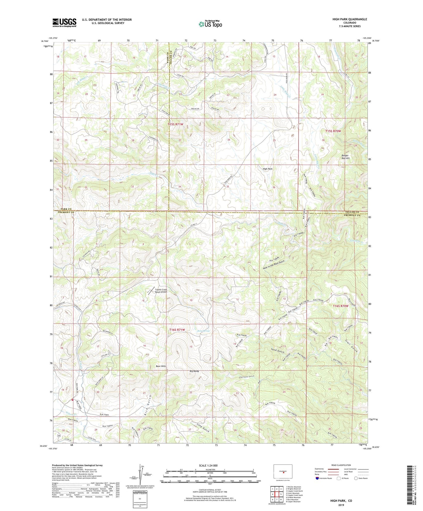
2022 topographic map quadrangle High Park in the state of Colorado. Scale: 1:24000. Based on the newly updated USGS 7.5' US Topo map series, this map is in the following counties: Fremont, Teller, Park. The map contains contour data, water features, and other items you are used to seeing on USGS maps, but also has updated roads and other features. This is the next generation of topographic maps. Printed on high-quality waterproof paper with UV fade-resistant inks.
Quads adjacent to this one:
West: Cover Mountain
Northwest: Witcher Mountain
North: Wrights Reservoir
Northeast: Cripple Creek North
East: Cripple Creek South
Southeast: Cooper Mountain
South: Rice Mountain
Southwest: Gribble Mountain
This map covers the same area as the classic USGS quad with code o38105f3.
Contains the following named places: Albany Mine, Bare Hills, Big Baldy, Blue Nugget Mine, Booger Red Hill, City Creek, Coyote Creek Ranch Airport, High Creek, High Park, Hole in the Rock Gulch, Little High Creek, Sheep Springs, Tallahassee Volunteer Fire Protection King Meadow Fire Station 6