
MyTopo
Yankee Gulch Colorado US Topo Map
Couldn't load pickup availability
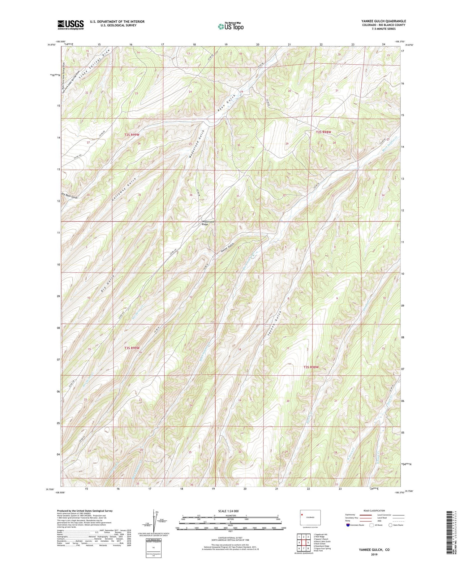
2022 topographic map quadrangle Yankee Gulch in the state of Colorado. Scale: 1:24000. Based on the newly updated USGS 7.5' US Topo map series, this map is in the following counties: Rio Blanco. The map contains contour data, water features, and other items you are used to seeing on USGS maps, but also has updated roads and other features. This is the next generation of topographic maps. Printed on high-quality waterproof paper with UV fade-resistant inks.
Quads adjacent to this one:
West: Black Cabin Gulch
Northwest: Sagebrush Hill
North: Wolf Ridge
Northeast: Square S Ranch
East: Rock School
Southeast: Bull Fork
South: Figure Four Spring
Southwest: Razorback Ridge
This map covers the same area as the classic USGS quad with code o39108g4.
Contains the following named places: Canyon Creek, Dry Gulch, Dry Ryan Gulch, Duckett Ranch, East Fawn Creek, Galloway Gulch, Left Fork Stake Springs Draw, Reigle Ranch, Right Fork Stake Springs Draw, Swizer Gulch, Wagonroad Gulch, West Fawn Creek, Wet Swizer Creek, Yankee Gulch


