MyTopo
Harbeson Delaware US Topo Map
Couldn't load pickup availability
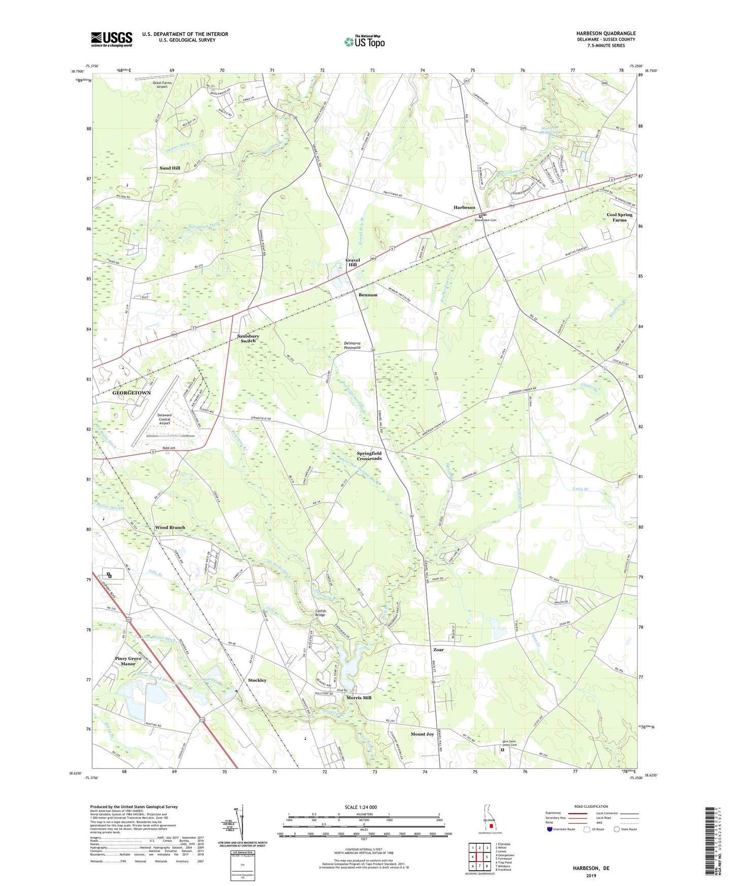
2023 topographic map quadrangle Harbeson in the state of Delaware. Scale: 1:24000. Based on the newly updated USGS 7.5' US Topo map series, this map is in the following counties: Sussex. The map contains contour data, water features, and other items you are used to seeing on USGS maps, but also has updated roads and other features. This is the next generation of topographic maps. Printed on high-quality waterproof paper with UV fade-resistant inks.
Quads adjacent to this one:
West: Georgetown
Northwest: Ellendale
North: Milton
Northeast: Lewes
East: Fairmount
Southeast: Frankford
South: Millsboro
Southwest: Trap Pond
This map covers the same area as the classic USGS quad with code o38075f3.
Contains the following named places: All Faith Chapel, Alms House Ditch, Andersons Corner, Apostolic Faith Church, Apostolics of Georgetown, Avalon Park Mobile Home Park, Beaverdam Cemetery, Bennum, Bethesda Church, Black Savannah Ditch, Bowdens Garage, Briarwood Manor, Broadkill Station, Cabbage Corner, Catfish Bridge, Cheer Community Center, Christiana Care LifeNet Air Medical Transport, Cool Spring Farms, Cool Spring Manor, Deep Branch, Deerwood, Delaware Coastal Airport, Delmarva Raceway, Dogwood Park Mobile Home Park, Dutton Ditch, Eli Walls Ditch, Fish Hook Mobile Home Court, Gills Branch, Gran-ville, Gravel Hill, Greenlea Acres, Harbeson, Harbeson Post Office, Holly Leaf Estates Mobile Home Park, Horse Pound Swamp Ditch, Hunters Millpond, Josephs Airport, Kawan Acres, Kingdom Hall of Jehovahs Witnesses, Lazy Lake, McGee Ditch, Milton Division, Morris Mill, Morris Millpond, Morris Millpond Dam, Mount Joy, New Saint Johns Cemetery, New Saint Johns Church, Patterson Place Mobile Home Park, Peterkins Branch, Pine Lake Development, Piney Grove Manor, Rogers Development, Saint Johns Church, Saint Johns United Methodist Church, Saint Peters Friends Church, Sand Hill, Sand Hill Church, Saulsbury Switch, Savannah Ditch, Shady Rest Park, Shingle Point, Simpler Branch, Sockorockets Ditch, Springfield Crossroads, Springfield Farms Addition, Stockley, Stockley Branch, Stockley Center, Sussex Central Senior High School, Sussex Community Corrections Center, Sussex Correctional Institution, Sussex County, Sussex County Industrial Park, The Apostolic Church, Triumph of the Church and Kingdom of God in Christ, Welsh Branch, White Horse Farm, White Oak Swamp Ditch, Wood Branch, Zoar, Zoar Church, ZIP Code: 19951