MyTopo
Alva Florida US Topo Map
Couldn't load pickup availability
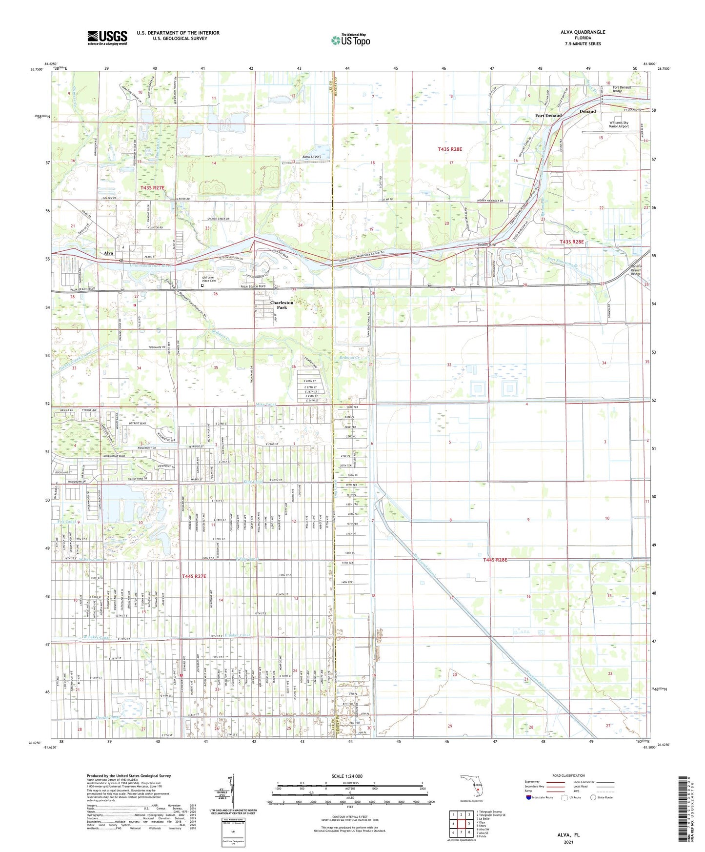
2024 topographic map quadrangle Alva in the state of Florida. Scale: 1:24000. Based on the newly updated USGS 7.5' US Topo map series, this map is in the following counties: Hendry, Lee. The map contains contour data, water features, and other items you are used to seeing on USGS maps, but also has updated roads and other features. This is the next generation of topographic maps. Printed on high-quality waterproof paper with UV fade-resistant inks.
Quads adjacent to this one:
West: Olga
Northwest: Telegraph Swamp
North: Telegraph Swamp SE
Northeast: La Belle
East: Sears
Southeast: Felda
South: Alva SE
Southwest: Alva SW
This map covers the same area as the classic USGS quad with code o26081f5.
Contains the following named places: Alma Airport, Alva, Alva Elementary School, Alva Fire and Rescue Service District, Alva Post Office, Alva United Methodist Church, Banana Branch, Banana Branch Bridge, Bedman Creek, Charleston Park, Charleston Park Census Designated Place, Cotton Strip, Covenant Presbyterian Church, Denaud, Dog Canal, East Baker Canal, East Easy Canal, First Baptist Church of Alva, Fort Denaud, Fort Denaud Bridge, Fort Denaud Census Designated Place, Fort Simmons Branch, How Canal, Jacks Branch, King Canal, Lehigh Acres, Lehigh Acres Fire Control and Rescue District Station 101, Love Canal, Mike Canal, Oak Park Mobile Village, Spanish Creek, The Alva School, Townsend Canal, United Methodist Camp, Upper Room House of Prayer Pentecostal Church, William's Sky Manor Airport, ZIP Code: 33972