MyTopo
Sears Florida US Topo Map
Couldn't load pickup availability
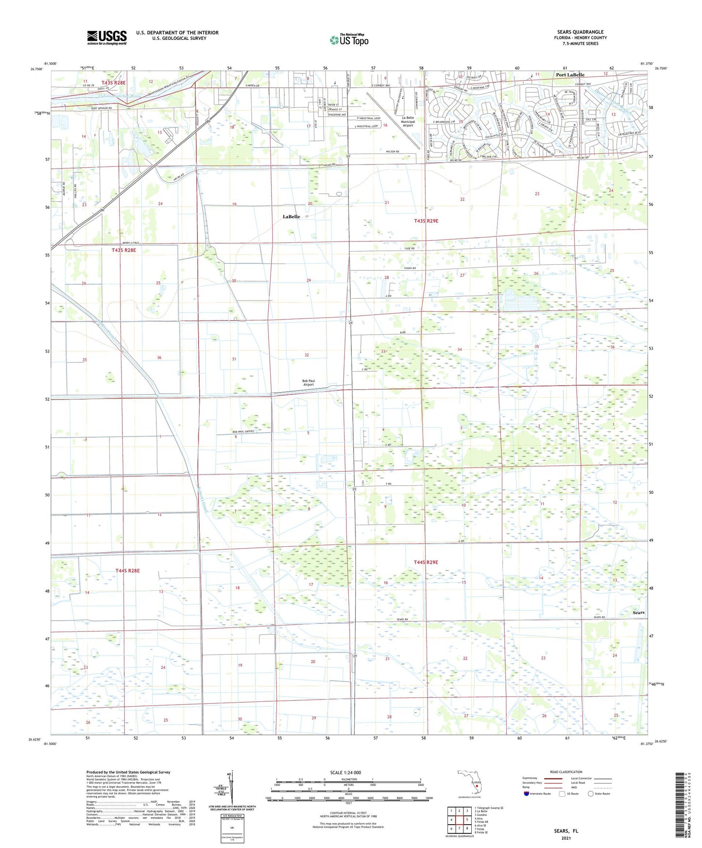
2024 topographic map quadrangle Sears in the state of Florida. Scale: 1:24000. Based on the newly updated USGS 7.5' US Topo map series, this map is in the following counties: Hendry. The map contains contour data, water features, and other items you are used to seeing on USGS maps, but also has updated roads and other features. This is the next generation of topographic maps. Printed on high-quality waterproof paper with UV fade-resistant inks.
Quads adjacent to this one:
West: Alva
Northwest: Telegraph Swamp SE
North: La Belle
Northeast: Goodno
East: Felda NE
Southeast: Felda SE
South: Felda
Southwest: Alva SE
This map covers the same area as the classic USGS quad with code o26081f4.
Contains the following named places: Berry Grove Airport, Bob Paul Airport, City of LaBelle, Edison State College - Hendry Glades Center, Elizondos Trailer Park, Faith Chapel Pentecostal Church of God, Hendry County Emergency Medical Services Station 219, La Belle Municipal Airport, LaBelle Elementary School, Roberts Canal, Sears, Southwest Citrus Airport, WKZY-FM (La Belle)