MyTopo
Anna Maria Florida US Topo Map
Couldn't load pickup availability
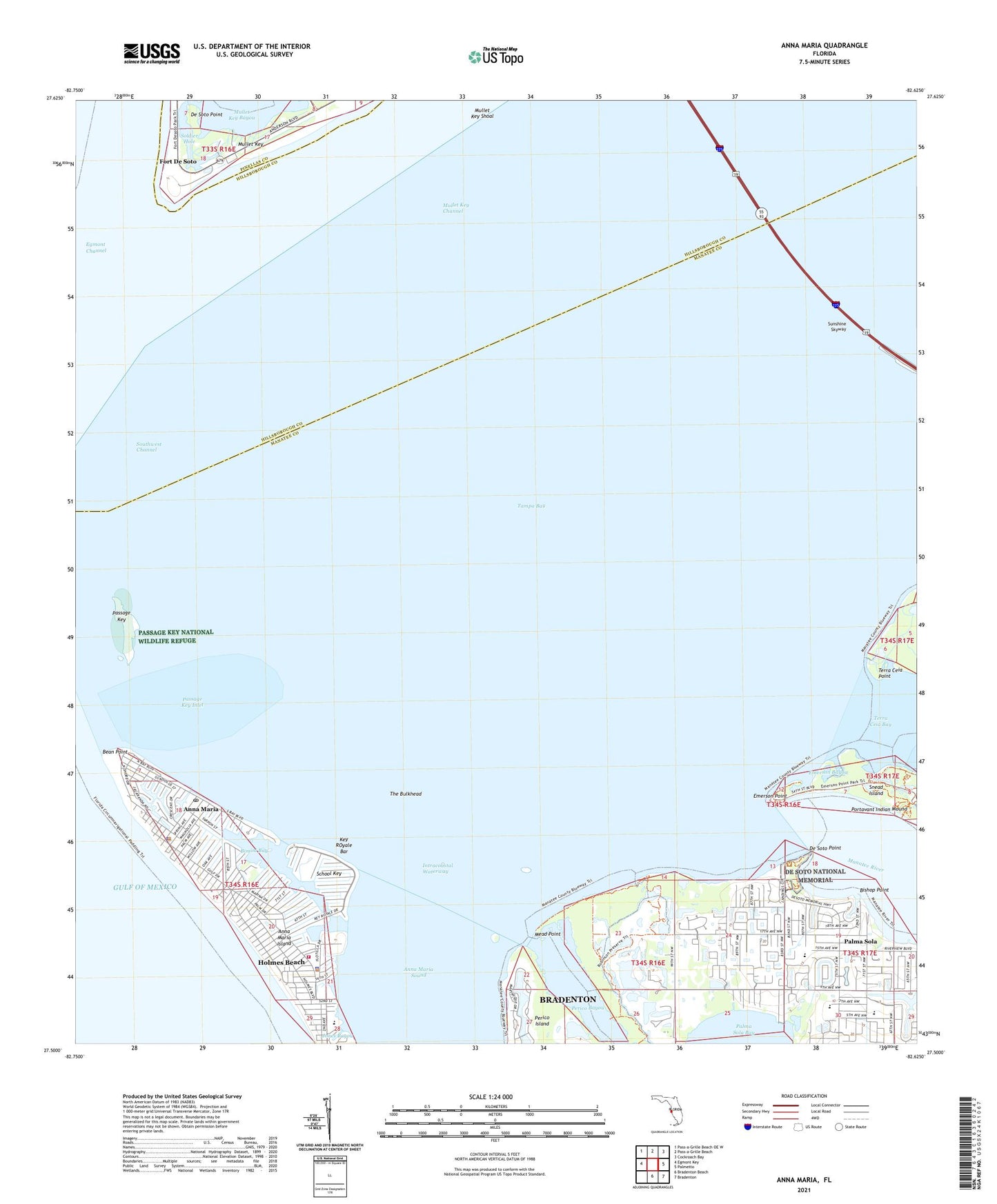
2025 topographic map quadrangle Anna Maria in the state of Florida. Scale: 1:24000. Based on the newly updated USGS 7.5' US Topo map series, this map is in the following counties: Manatee, Hillsborough, Pinellas. The map contains contour data, water features, and other items you are used to seeing on USGS maps, but also has updated roads and other features. This is the next generation of topographic maps. Printed on high-quality waterproof paper with UV fade-resistant inks.
Quads adjacent to this one:
West: Egmont Key
Northwest: Pass-a-Grille Beach OE W
North: Pass-a-Grille Beach
Northeast: Cockroach Bay
East: Palmetto
Southeast: Bradenton
South: Bradenton Beach
This map covers the same area as the classic USGS quad with code o27082e6.
Contains the following named places: Anna Maria, Anna Maria Elementary School, Anna Maria Island, Anna Maria Post Office, Battery Bigelow, Battery Laidley, Bean Point, Bimini Bay, Bishop Point, City of Anna Maria, City of Holmes Beach, De Soto Monument, De Soto National Memorial, De Soto Point, Emerson Bayou, Emerson Point, Fort De Soto, Fort De Soto Park, Holmes Beach Police Department, Holmes Beach Post Office, Jones Bayou, Key ROyale Bar, King Middle School, Manatee County Beach, Manatee County Sheriff's Office District 5 Anna Maria Unit, Manatee River, Mead Point, Muller Key Channel Fishing Pier Lights, Mullet Key, Mullet Key Channel, Mullet Key Shoal, Northwest Baptist Church, Palma Sola, Palma Sola Church, Palma Sola Elementary School, Passage Key, Passage Key Inlet, Passage Key National Wildlife Refuge, Passage Key Wilderness, Perico Bayou, Portavant Indian Mound, School Key, Soldier Hole, Terra Ceia Point, The Bulkhead, West Manatee Fire and Rescue Department, West Manatee Fire and Rescue Station 3, ZIP Codes: 34209, 34216