MyTopo
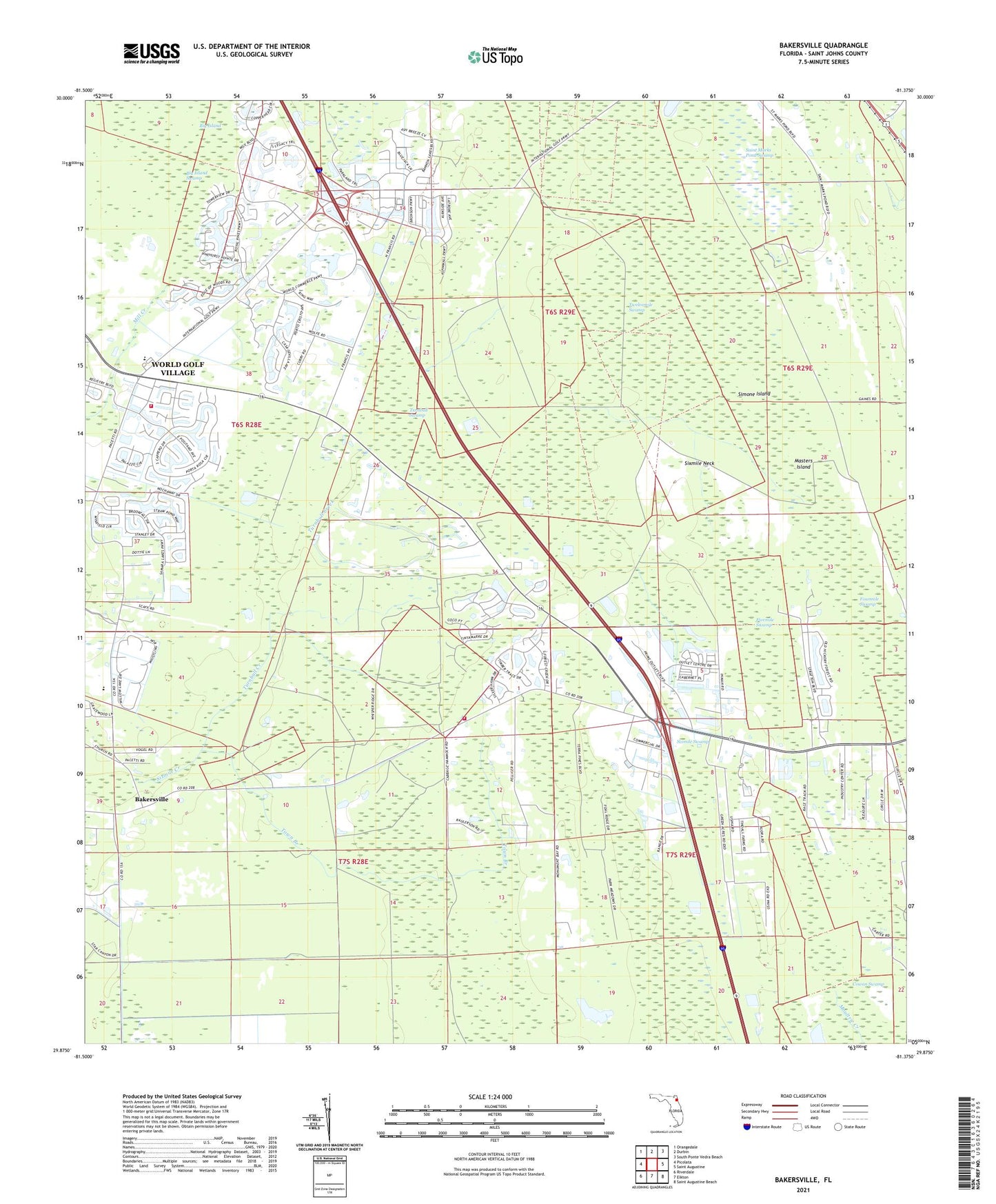
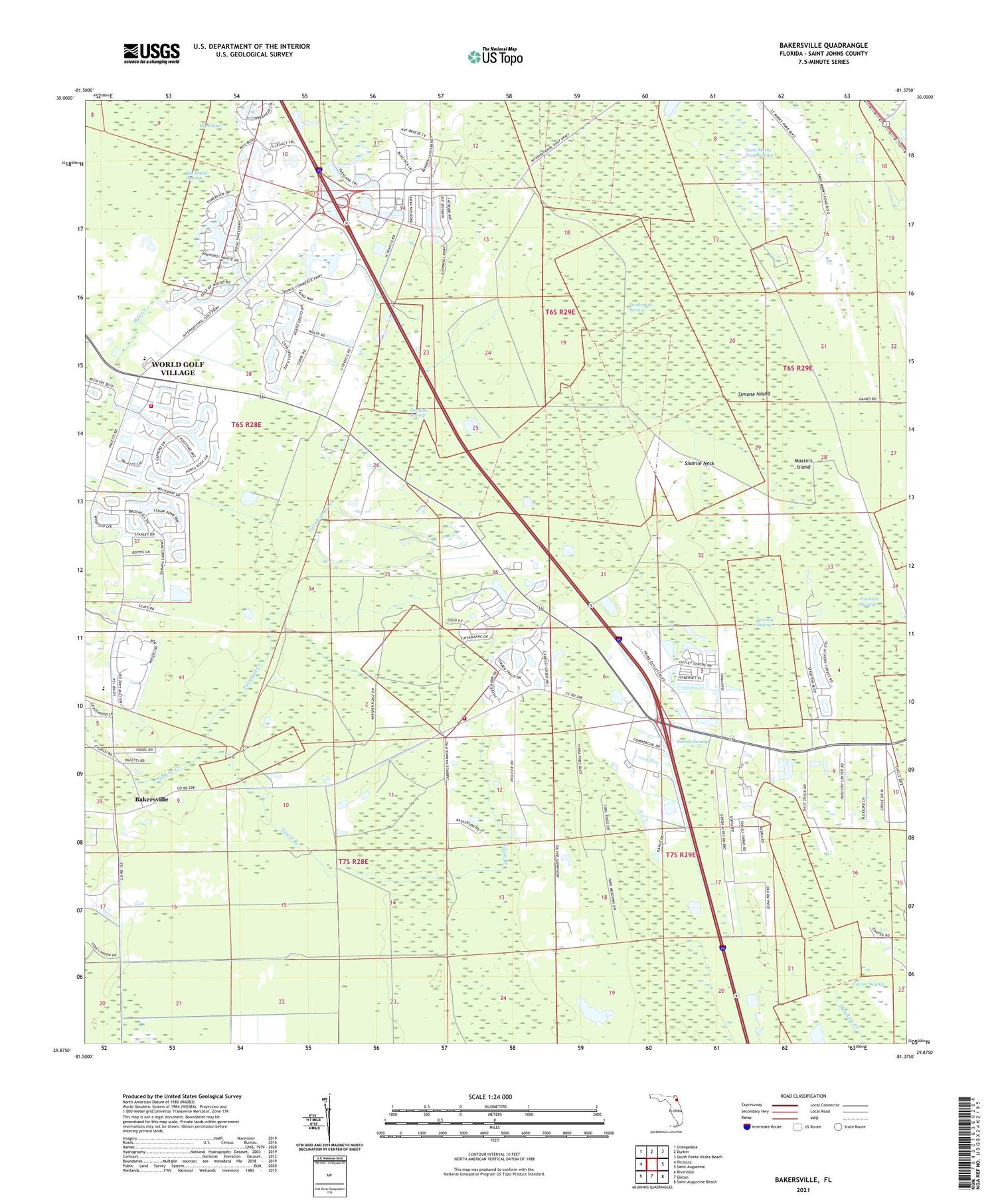
Bakersville Florida US Topo Map
Couldn't load pickup availability
2024 topographic map quadrangle Bakersville in the state of Florida. Scale: 1:24000. Based on the newly updated USGS 7.5' US Topo map series, this map is in the following counties: St. Johns. The map contains contour data, water features, and other items you are used to seeing on USGS maps, but also has updated roads and other features. This is the next generation of topographic maps. Printed on high-quality waterproof paper with UV fade-resistant inks.
Quads adjacent to this one:
West: Picolata
Northwest: Orangedale
North: Durbin
Northeast: South Ponte Vedra Beach
East: Saint Augustine
Southeast: Saint Augustine Beach
South: Elkton
Southwest: Riverdale
This map covers the same area as the classic USGS quad with code o29081h4.
Contains the following named places: Bakersville, Bakersville Tower, Big Island, Cowan Swamp, Fivemile Swamp, Fourmile Swamp, Francis Naval Outer Landing Field, Glimpse of Glory, Masters Island, Mill Creek School, Saint Augustine Division, Saint Johns County, Saint Johns County Fire Rescue Station 16 - World Golf Village, Saint Johns County Fire Rescue Station 4 - Bakersville, Saint Marks Pond Swamp, Simone Island, Sixmile Neck, Sixmile Swamp, Sunshine Farms Airport, The Evergreen Club, Town Branch, Turnbull Creek, Turnbull Swamp, Whispering Oaks Gardens Mobile Home Park, WHWY-AM (Saint Augustine Beach), World Golf Village Census Designated Place, WSOS-FM (Saint Augustine)