MyTopo
Picolata Florida US Topo Map
Couldn't load pickup availability
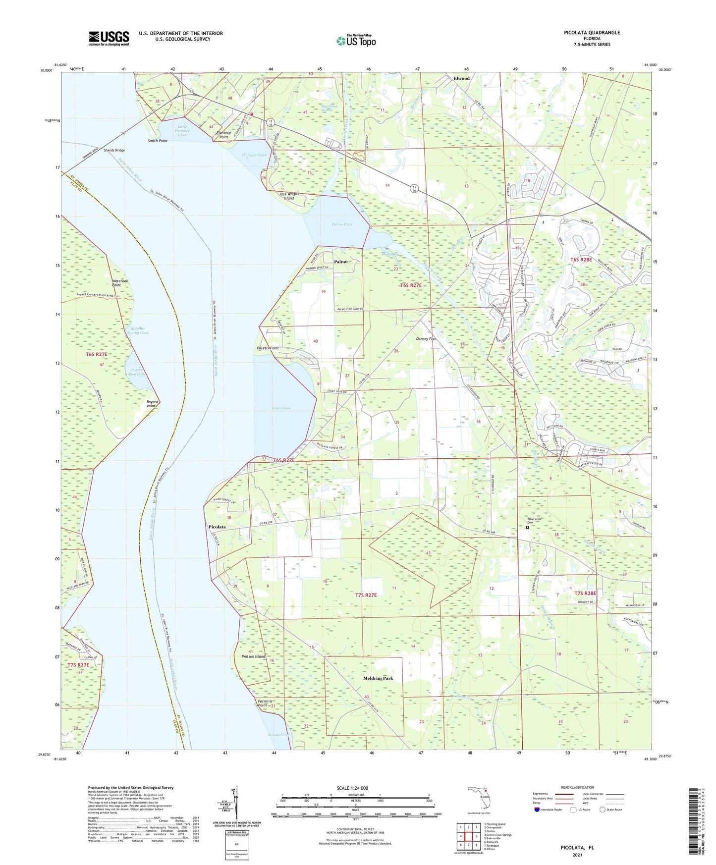
2024 topographic map quadrangle Picolata in the state of Florida. Scale: 1:24000. Based on the newly updated USGS 7.5' US Topo map series, this map is in the following counties: St. Johns, Clay. The map contains contour data, water features, and other items you are used to seeing on USGS maps, but also has updated roads and other features. This is the next generation of topographic maps. Printed on high-quality waterproof paper with UV fade-resistant inks.
Quads adjacent to this one:
West: Green Cove Springs
Northwest: Fleming Island
North: Orangedale
Northeast: Durbin
East: Bakersville
Southeast: Elkton
South: Riverdale
Southwest: Bostwick
This map covers the same area as the classic USGS quad with code o29081h5.
Contains the following named places: Bakersville Cemetery, Bass Haven, Bayard Point, Bethany Bible Church, Clarkes Creek, Colee, Colee Cove, Dancey Flat, Deer Creek Ranch, Elwood, Ferreira Point, Florence, Florence Cove, Florence Point, Fort Picolata, Hogarths Landing, Honey Branch, Jack Wright Island, Little Florence Cove, Magnolia Landing, Meldrim Park, Mill Creek, Mill Creek Baptist Church, Mount Olive Church, Mount Pleasant Church, Mud Alley, Pacetti Point, Pacettis Marina, Palmo, Palmo Cove, Picolata, Picolata School, Pocotalaco, Puerto Rico Cove, Saint Johns, Saint Johns County Fire Rescue Station 3 - Orangedale, Saint Johns County Fire Rescue Station 3A, Saint Joseph Missionary Baptist Church, Shands Bridge, Sixmile Creek, Smith Point, Solano Cove, Sulphur Spring Cove, Trout Creek, Wards Creek, Wards Creek Community Church, Wateroak Point, Watson Island, Wolfe Ranch, ZIP Code: 32092