MyTopo
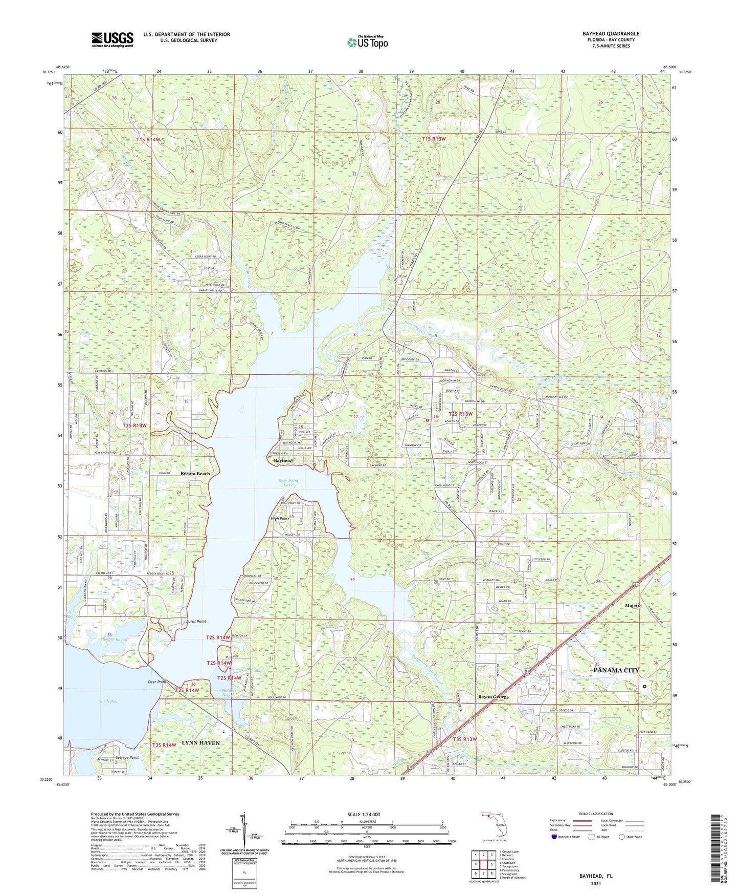
Bayhead Florida US Topo Map
Couldn't load pickup availability
2024 topographic map quadrangle Bayhead in the state of Florida. Scale: 1:24000. Based on the newly updated USGS 7.5' US Topo map series, this map is in the following counties: Bay. The map contains contour data, water features, and other items you are used to seeing on USGS maps, but also has updated roads and other features. This is the next generation of topographic maps. Printed on high-quality waterproof paper with UV fade-resistant inks.
Quads adjacent to this one:
West: Southport
Northwest: Crystal Lake
North: Bennett
Northeast: Fountain
East: Youngstown
Southeast: North of Allanton
South: Springfield
Southwest: Panama City
This map covers the same area as the classic USGS quad with code o30085c5.
Contains the following named places: Bay Correctional Facility, Bayhead, Bayou George, Bayou George Assembly of God Church, Bayou George Creek, Bayou George Volunteer Fire Department, Bear Creek, Beatty Bayou, Burnt Point, Camp Flowers, Cedar Creek, Clear Creek, Clearwater Pond, Coastal Helicopters Incorporated Heliport, College Point, Deer Point, Deer Point Lake, Dry Branch, Econfina Creek, First Baptist Church of Bayou George, Gainer Bayou, High Point, Hodges Bayou, Juniper Creek, Little Cedar Creek, Long Branch, Lynn Haven Division, Majette, McAllaster Landing, McAllister Landing, Mill Bayou, Resota Beach, Williams Bayou