
MyTopo
Crystal Lake Florida US Topo Map
Couldn't load pickup availability
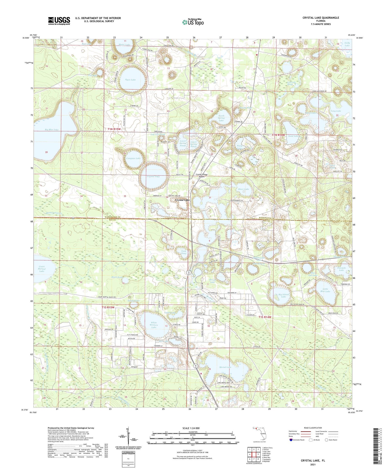
2024 topographic map quadrangle Crystal Lake in the state of Florida. Scale: 1:24000. Based on the newly updated USGS 7.5' US Topo map series, this map is in the following counties: Bay, Washington. The map contains contour data, water features, and other items you are used to seeing on USGS maps, but also has updated roads and other features. This is the next generation of topographic maps. Printed on high-quality waterproof paper with UV fade-resistant inks.
Quads adjacent to this one:
West: Red Head
Northwest: Millers Ferry
North: Vernon
Northeast: Gap Lake
East: Bennett
Southeast: Bayhead
South: Southport
Southwest: West Bay
This map covers the same area as the classic USGS quad with code o30085d6.
Contains the following named places: Big Blue Lake, Big Island Lake, Bird Lake, Black Pond, Bream Lake, Brit Lake, Calf Lake, Clearwater Branch, CML Airport, Compass Lake, Court Martial Lake, Crystal Lake, Crystal Village Airport, Gator Pond, Greenhead Volunteer Fire Department, Island Pond, Lake Five-O, Little Blue Lake, Little Island Lake, Log Cart Pond, Long Lake, Long Lake Slough, Lower Spring Ponds, Major Lake, Merial Lake, North Spring Lake, Open Lake, Piney Lake, Rattlesnake Lake, River Lake, Sand Hills Volunteer Fire Department, Sand Lake, Shirt Tail Lake, Sunset Lake, Tank Pond, Turkey Pond, Tyson Lake, Wash Pond, White Western Lake, Woody Pond, WPFM-FM (Panama City)


