MyTopo
Youngstown Florida US Topo Map
Couldn't load pickup availability
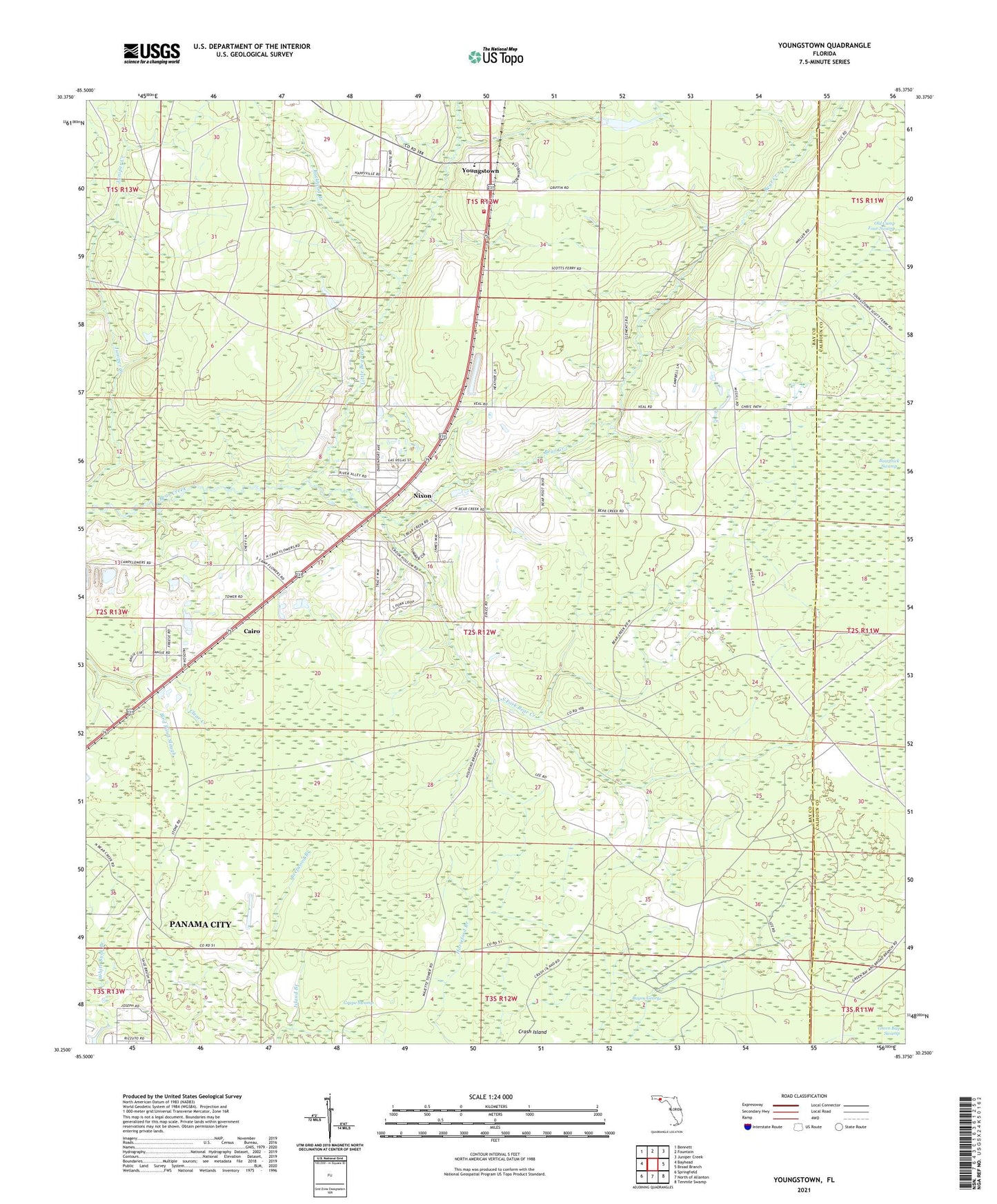
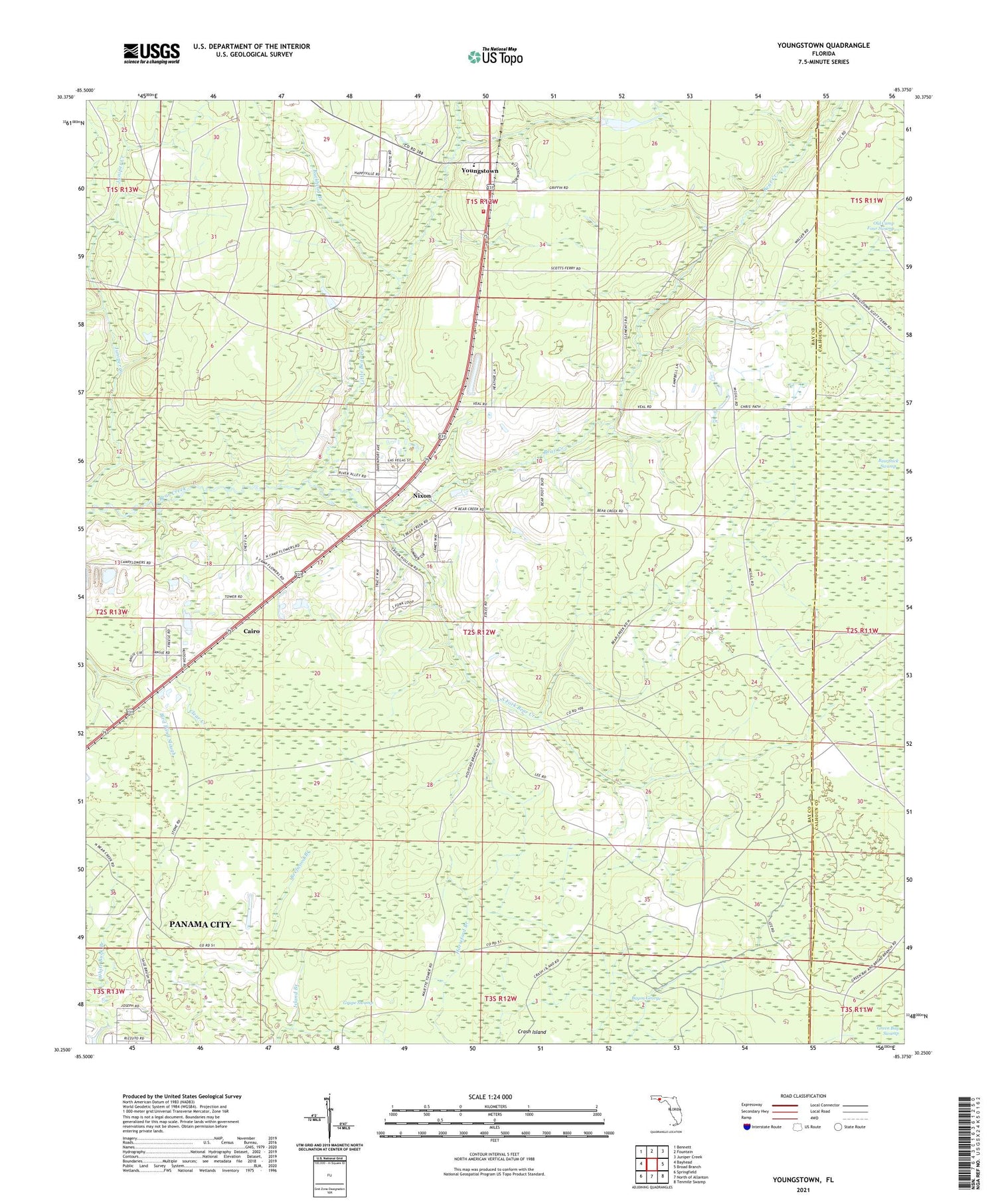
2024 topographic map quadrangle Youngstown in the state of Florida. Scale: 1:24000. Based on the newly updated USGS 7.5' US Topo map series, this map is in the following counties: Bay, Calhoun. The map contains contour data, water features, and other items you are used to seeing on USGS maps, but also has updated roads and other features. This is the next generation of topographic maps. Printed on high-quality waterproof paper with UV fade-resistant inks.
Quads adjacent to this one:
West: Bayhead
Northwest: Bennett
North: Fountain
Northeast: Juniper Creek
East: Broad Branch
Southeast: Tenmile Swamp
South: North of Allanton
Southwest: Springfield
This map covers the same area as the classic USGS quad with code o30085c4.
Contains the following named places: Bayou George, Bear Creek Assembly of God Church, Bear Creek Church, Bear Creek Youngstown Fire Department, Bearthick Swamp, Bird Pond Slough, Buckhead Branch, Cairo, Green Bay Swamp, Little Bear Creek, Nixon, South Fork Bear Creek, Waller Elementary School, WMBB-TV (Panama City), WPAP-FM (Panama City), Youngstown, Youngstown Post Office