MyTopo
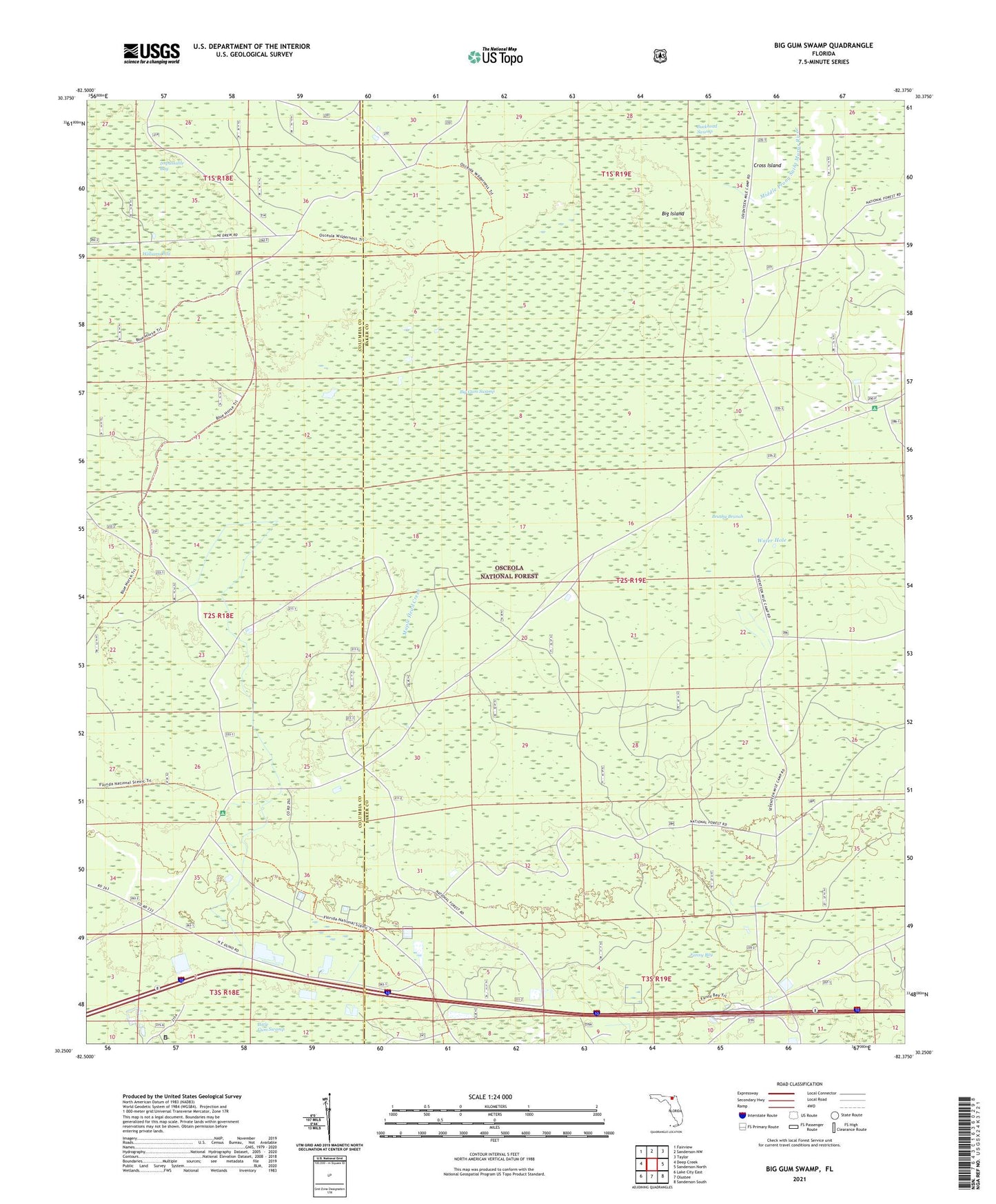
Big Gum Swamp Florida US Topo Map
Couldn't load pickup availability
Also explore the Big Gum Swamp Forest Service Topo of this same quad for updated USFS data
2024 topographic map quadrangle Big Gum Swamp in the state of Florida. Scale: 1:24000. Based on the newly updated USGS 7.5' US Topo map series, this map is in the following counties: Baker, Columbia. The map contains contour data, water features, and other items you are used to seeing on USGS maps, but also has updated roads and other features. This is the next generation of topographic maps. Printed on high-quality waterproof paper with UV fade-resistant inks.
Quads adjacent to this one:
West: Deep Creek
Northwest: Fairview
North: Sanderson NW
Northeast: Taylor
East: Sanderson North
Southeast: Sanderson South
South: Olustee
Southwest: Lake City East
This map covers the same area as the classic USGS quad with code o30082c4.
Contains the following named places: Big Gum Swamp, Big Gum Swamp Wilderness, Big Island, Brushy Branch, Cross Island, Fanny Bay, Interstate 10 Rest Area North, Interstate 10 Rest Area South, Maple Head Creek, Osceola National Forest, Osceola Wildlife Management Area, Seventeenmile Camp, Water Hole, Williams Bay