MyTopo
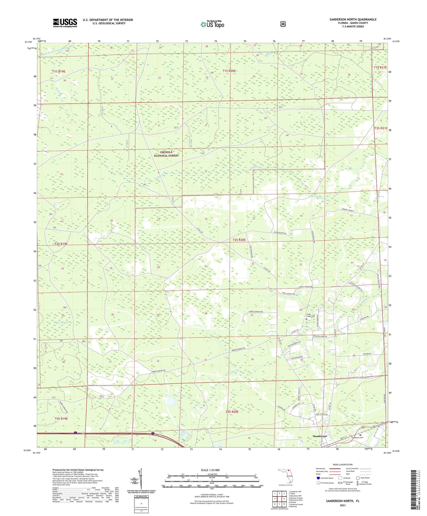
Sanderson North Florida US Topo Map
Couldn't load pickup availability
Also explore the Sanderson North Forest Service Topo of this same quad for updated USFS data
2024 topographic map quadrangle Sanderson North in the state of Florida. Scale: 1:24000. Based on the newly updated USGS 7.5' US Topo map series, this map is in the following counties: Baker. The map contains contour data, water features, and other items you are used to seeing on USGS maps, but also has updated roads and other features. This is the next generation of topographic maps. Printed on high-quality waterproof paper with UV fade-resistant inks.
Quads adjacent to this one:
West: Big Gum Swamp
Northwest: Sanderson NW
North: Taylor
Northeast: Macclenny NW
East: Macclenny West
Southeast: Manning
South: Sanderson South
Southwest: Olustee
This map covers the same area as the classic USGS quad with code o30082c3.
Contains the following named places: Baker County, Cedar Creek Cemetery, Cedar Creek Church, Central School, Dinkins New Congregational Methodist Church, Hurricane Bay, New Dinkins Church, Rudy Branch, Saint Johns Church, Sanderson, Sanderson Cemetery, Sanderson Division