MyTopo
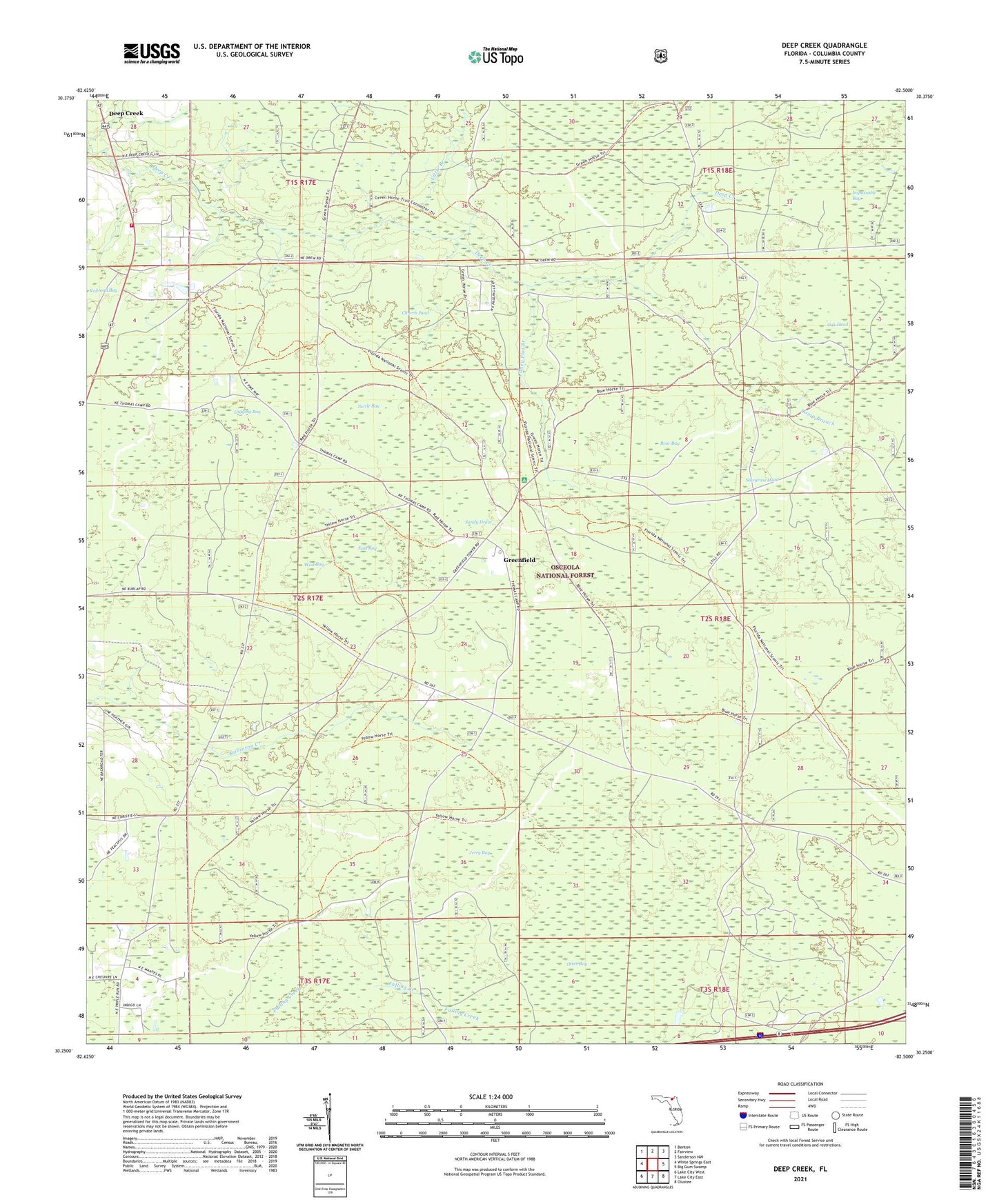
Deep Creek Florida US Topo Map
Couldn't load pickup availability
Also explore the Deep Creek Forest Service Topo of this same quad for updated USFS data
2024 topographic map quadrangle Deep Creek in the state of Florida. Scale: 1:24000. Based on the newly updated USGS 7.5' US Topo map series, this map is in the following counties: Columbia. The map contains contour data, water features, and other items you are used to seeing on USGS maps, but also has updated roads and other features. This is the next generation of topographic maps. Printed on high-quality waterproof paper with UV fade-resistant inks.
Quads adjacent to this one:
West: White Springs East
Northwest: Benton
North: Fairview
Northeast: Sanderson NW
East: Big Gum Swamp
Southeast: Olustee
South: Lake City East
Southwest: Lake City West
This map covers the same area as the classic USGS quad with code o30082c5.
Contains the following named places: Bear Bay, Camp Branch, Caney Flat Branch, Church Pond, Deep Creek, Deep Creek Volunteer Fire Department Station 41, East Bay, Falling Creek, Greenfield, Jerry Bay, Little Branch, Logging Bay, Oak Head, Osceola Trail, Otter Bay, Sandy Drain, Sawgrass Head, Turtle Bay, West Bay, West Lookout Tower, West Tower Hunt Camp, ZIP Code: 32055