
MyTopo
Bonifay Florida US Topo Map
Couldn't load pickup availability
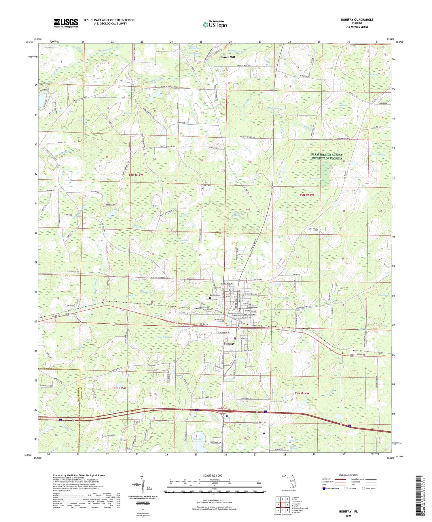
2024 topographic map quadrangle Bonifay in the state of Florida. Scale: 1:24000. Based on the newly updated USGS 7.5' US Topo map series, this map is in the following counties: Holmes, Washington. The map contains contour data, water features, and other items you are used to seeing on USGS maps, but also has updated roads and other features. This is the next generation of topographic maps. Printed on high-quality waterproof paper with UV fade-resistant inks.
Quads adjacent to this one:
West: Caryville
Northwest: Izagora
North: Esto
Northeast: Graceville
East: Chipley
Southeast: Wausau
South: Poplar Head
Southwest: Hinsons Crossroads
This map covers the same area as the classic USGS quad with code o30085g6.
Contains the following named places: Bear Bay, Black Lake, Bonifay, Bonifay Division, Bonifay Elementary School, Bonifay Fire and Rescue, Bonifay Police Department, Bonifay Post Office, Camp Branch, City of Bonifay, Doctors Memorial Hospital, Doctors Memorial Hospital Heliport, Gully Springs Church, Gum Branch, Gum Creek Swamp, Harrell Bay, Hillcrest Special Education School, Holmes Correctional Institution, Holmes County Adult Education School, Holmes County Emergency Medical Services, Holmes County High School, Holmes County Sheriff's Office, Hoover Mill, Hurricane Bay, Liberty Church, Little Gum Creek, Little Rock Church, Live Oak School, Long Bay, Long Round Bay, Martins Bay, Meetinghouse Bay, Moccasin Bay, Mount Olive Church, Mud Path Bay, New Smyrna Church, Pate Pond, Saint Johns Church, Sand Path Bay, Sand Ridge School, Spring Hill Church, Still Cemetery, Sun Lake, Tenmile Creek, Tharpe Airport, Titi Branch, Tom Williams Bay, ZIP Code: 32425


