MyTopo
Branchborough Florida US Topo Map
Couldn't load pickup availability
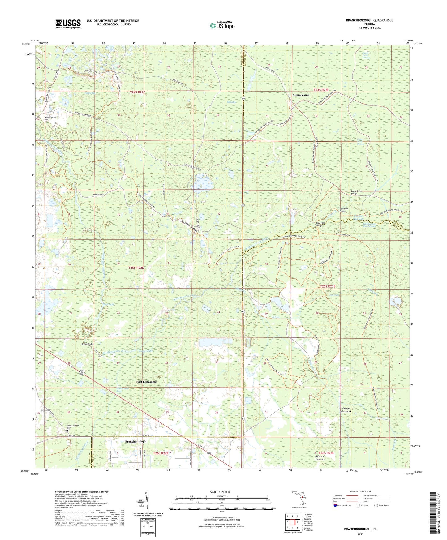
2024 topographic map quadrangle Branchborough in the state of Florida. Scale: 1:24000. Based on the newly updated USGS 7.5' US Topo map series, this map is in the following counties: Pasco, Polk, Sumter. The map contains contour data, water features, and other items you are used to seeing on USGS maps, but also has updated roads and other features. This is the next generation of topographic maps. Printed on high-quality waterproof paper with UV fade-resistant inks.
Quads adjacent to this one:
West: Dade City
Northwest: Lacoochee
North: Clay Sink
Northeast: Bay Lake
East: Rock Ridge
Southeast: Providence
South: Socrum
Southwest: Zephyrhills
This map covers the same area as the classic USGS quad with code o28082c1.
Contains the following named places: Ashley Bay, Blue Lake, Bonnet Lake, Branchborough, Branchborough Church, Brown Bridge, Colt Creek, Cow Ford Bridge, Cross Creek, Cross Creek Bridge, Cross Creek Swamp, Cumpressco, Devils Creek Swamp, Gator Creek, Hillsborough River, Mills Bay, Mud Lake, Orange Hammock, Port Lonesome, Sixteen Section Pond, Stanley Fish Hole, Thrasher Ridges, Trial Ford Bridge, Wildwood Shopping Center, Williams Hammock, Withlacoochee Cemetery