MyTopo
Brooksville SE Florida US Topo Map
Couldn't load pickup availability
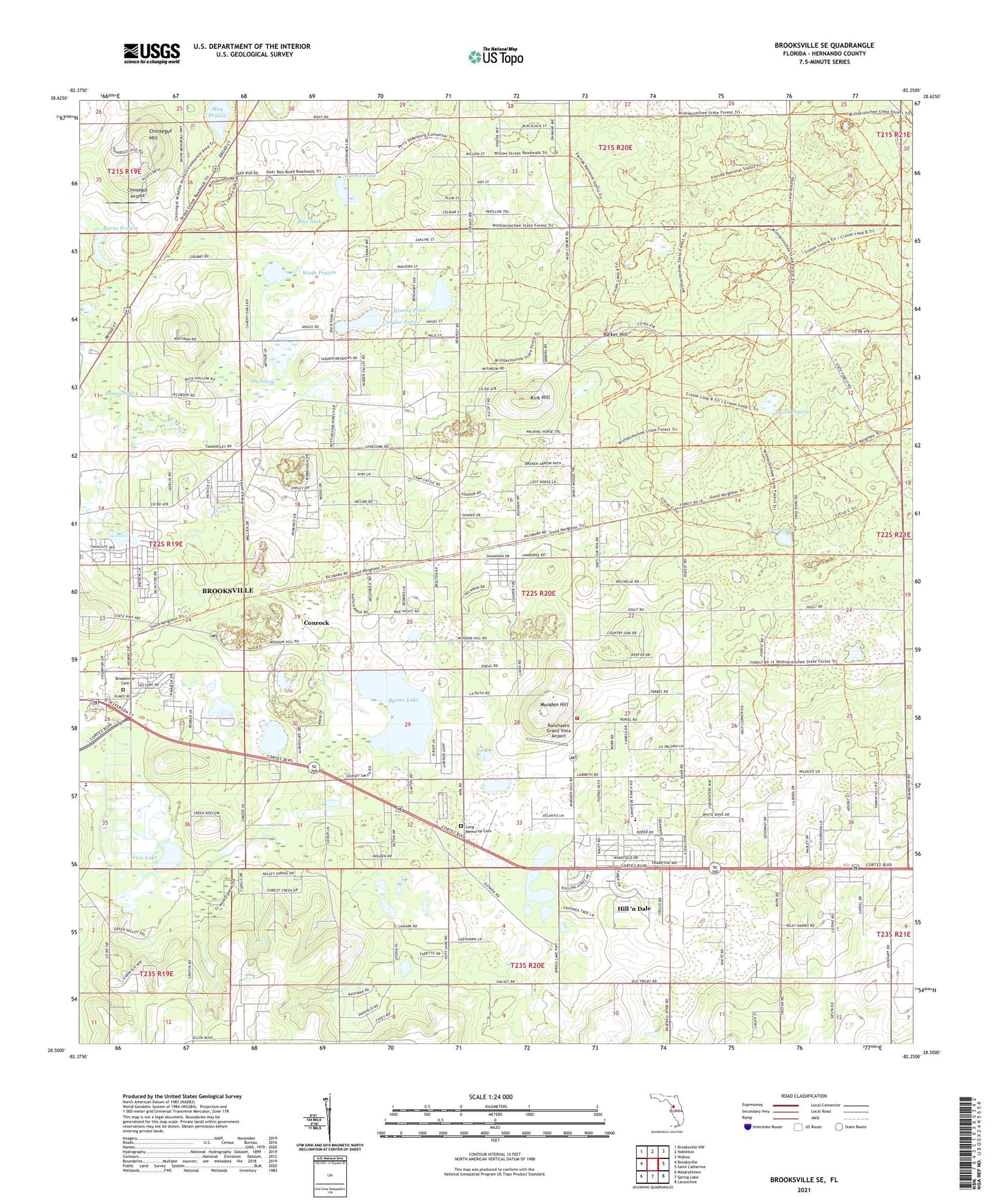
2024 topographic map quadrangle Brooksville SE in the state of Florida. Scale: 1:24000. Based on the newly updated USGS 7.5' US Topo map series, this map is in the following counties: Hernando. The map contains contour data, water features, and other items you are used to seeing on USGS maps, but also has updated roads and other features. This is the next generation of topographic maps. Printed on high-quality waterproof paper with UV fade-resistant inks.
Quads adjacent to this one:
West: Brooksville
Northwest: Brooksville NW
North: Nobleton
Northeast: Wahoo
East: Saint Catherine
Southeast: Lacoochee
South: Spring Lake
Southwest: Masaryktown
This map covers the same area as the classic USGS quad with code o28082e3.
Contains the following named places: Blue Sink, Brooksville Cemetery, Brooksville Division, Brooksville Quarry, Brooksville Wesleyan Church, Burns Prairie, Bystre Lake, Camp Quarry, Chinsegut Airport, Chinsegut Hill, Chinsegut National Wildlife Refuge, Community Bible Church, Conrock, Coogler Pond, Croom Wildlife Management Area, Dry Prairie, Eastside Elementary School, Grassy Pond, Harris Pond, Hernando Christian Academy, Hernando County Fire Rescue Station 7, Hill 'n Dale, Hill 'n Dale Census Designated Place, Hillside Community Baptist Church, Irvin Lake, Kirk Hill, Long Memorial Cemetery, May Prairie, Mount Zion AME Church, Munden Hill, New Apostolic Church, New Hope Assembly of God, Ramsey Pond, Ranchaero Grand Vista Airport, Saint Lewis Missionary Baptist Church, Smith Prairie, Tucker Hill, Tucker Hill Forestry Site, Twin Pond, Wade Prairie, ZIP Codes: 34601, 34602