MyTopo
Brooksville NW Florida US Topo Map
Couldn't load pickup availability
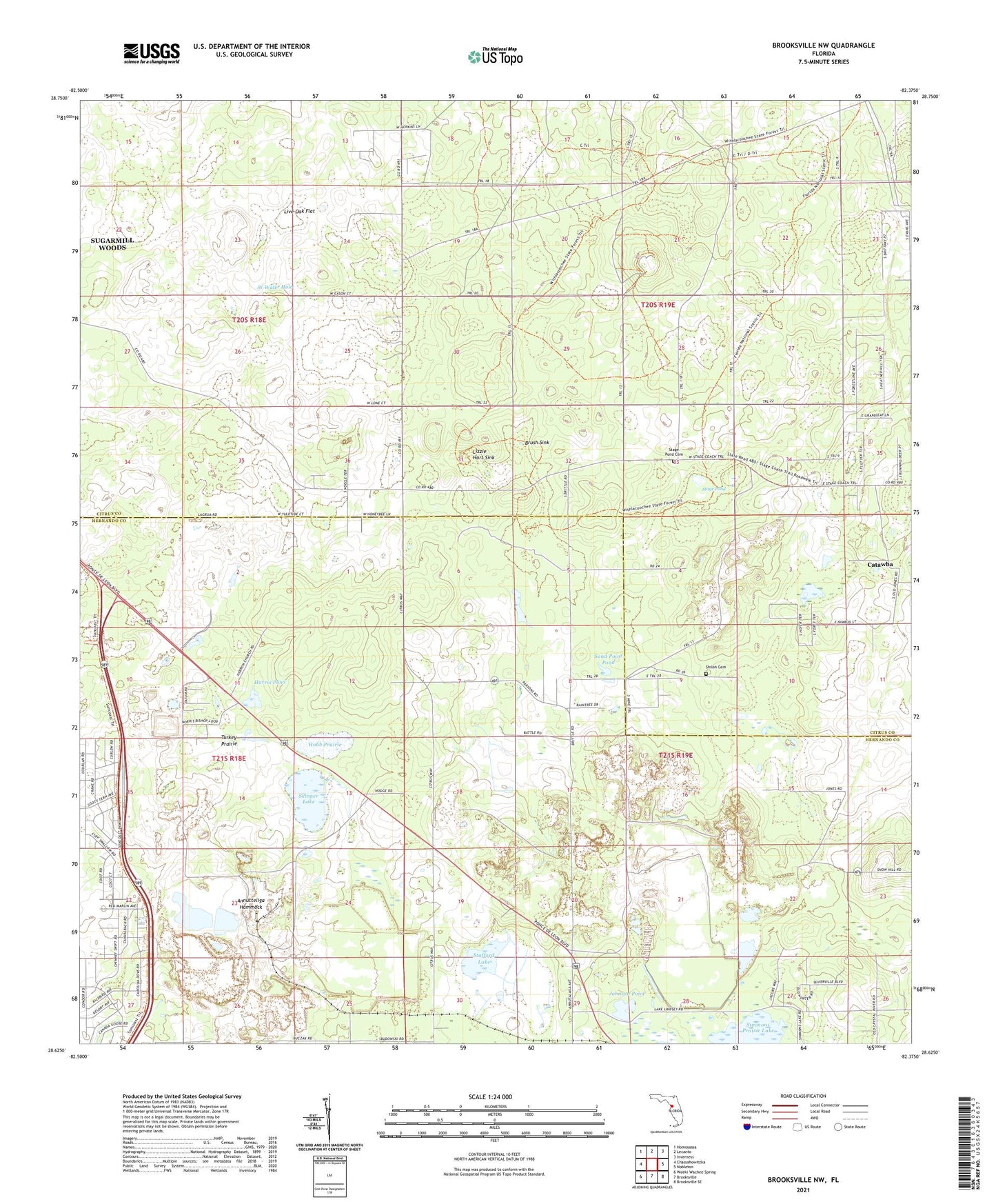
2024 topographic map quadrangle Brooksville NW in the state of Florida. Scale: 1:24000. Based on the newly updated USGS 7.5' US Topo map series, this map is in the following counties: Citrus, Hernando. The map contains contour data, water features, and other items you are used to seeing on USGS maps, but also has updated roads and other features. This is the next generation of topographic maps. Printed on high-quality waterproof paper with UV fade-resistant inks.
Quads adjacent to this one:
West: Chassahowitzka
Northwest: Homosassa
North: Lecanto
Northeast: Inverness
East: Nobleton
Southeast: Brooksville SE
South: Brooksville
Southwest: Weeki Wachee Spring
This map covers the same area as the classic USGS quad with code o28082f4.
Contains the following named places: Annutteliga Hammock, Brush Sink, Catawba, Hammock School, Harris Pond, Hebron Baptist Church, Hernando County Rock Canning Center & Library, Hobb Prairie, Horse Lake, Johnson Pond, Live Oak Flat, Lizzie Hart Sink, Oak Grove Community Hall, Ringhaver Heliport, Saint Joseph Church, Saint Stanislaus Catholic Church, Sand Point Pond, Shiloh Baptist Church, Shiloh Cemetery, Simmons Prairie Lake, Skinner Lake, Stafford Church, Stafford Lake, Stafford Siding, Stage Pond, Stage Pond Cemetery, Sunset Plaza, Tillis Hills Recreation Area, Turkey Prairie, W Water Hole