MyTopo
Cape San Blas Florida US Topo Map
Couldn't load pickup availability
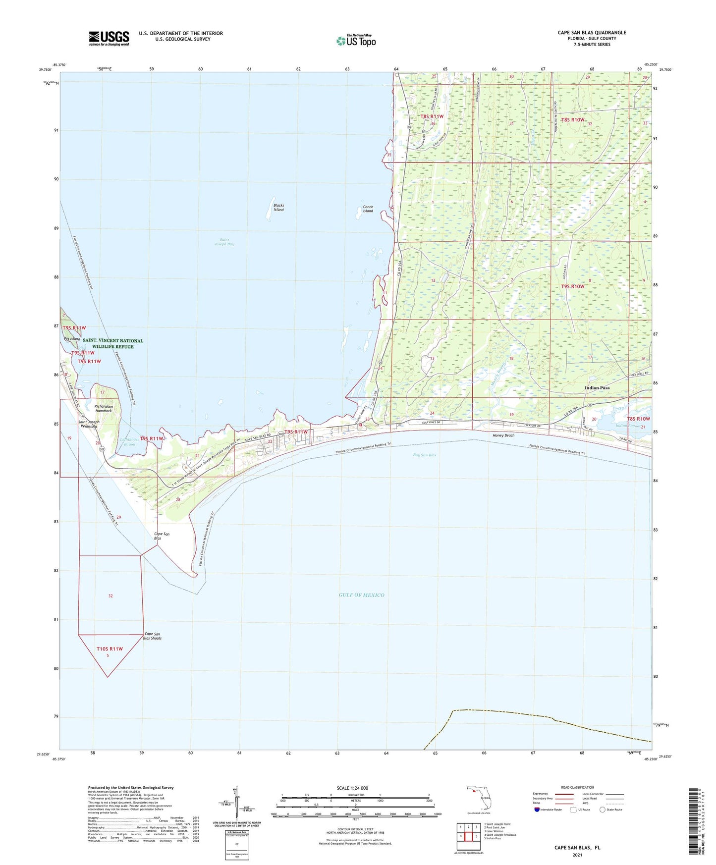
2025 topographic map quadrangle Cape San Blas in the state of Florida. Scale: 1:24000. Based on the newly updated USGS 7.5' US Topo map series, this map is in the following counties: Gulf. The map contains contour data, water features, and other items you are used to seeing on USGS maps, but also has updated roads and other features. This is the next generation of topographic maps. Printed on high-quality waterproof paper with UV fade-resistant inks.
Quads adjacent to this one:
West: Saint Joseph Peninsula
Northwest: Saint Joseph Point
North: Port Saint Joe
Northeast: Lake Wimico
East: Indian Pass
This map covers the same area as the classic USGS quad with code o29085f3.
Contains the following named places: Bay San Blas, Blacks Island, Camp Palm, Cape San Blas, Cape San Blas Lighthouse, Cape San Blas Shoals, Conch Island, Indian Pass, Lighthouse Bayou, Money Bayou, Money Beach, Pig Bayou, Pig Island, Richardson Hammock, South Gulf County Volunteer Fire Department Station 1