MyTopo
Indian Pass Florida US Topo Map
Couldn't load pickup availability
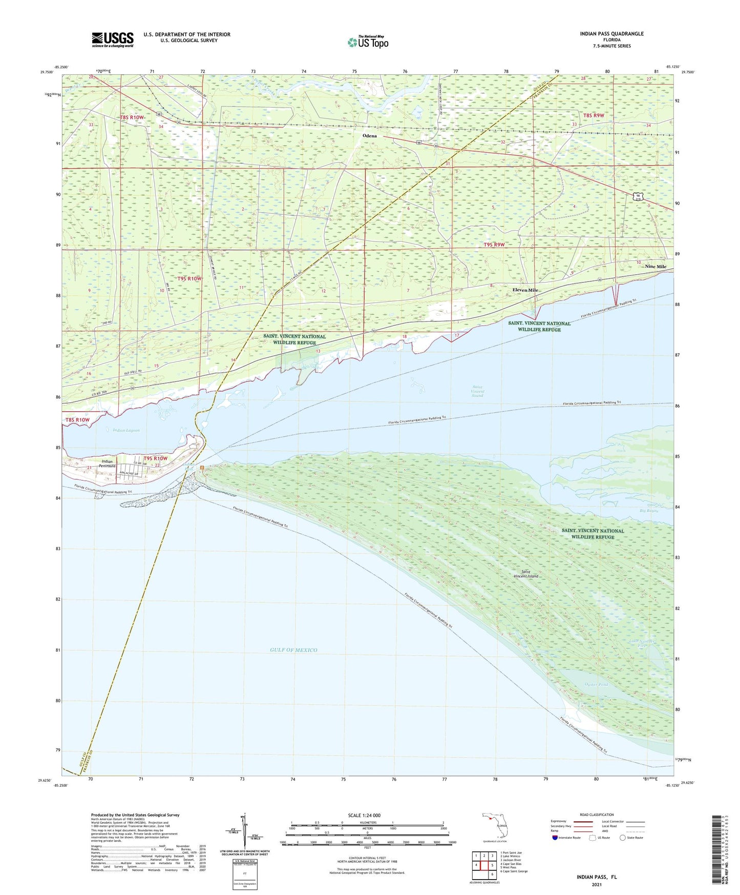
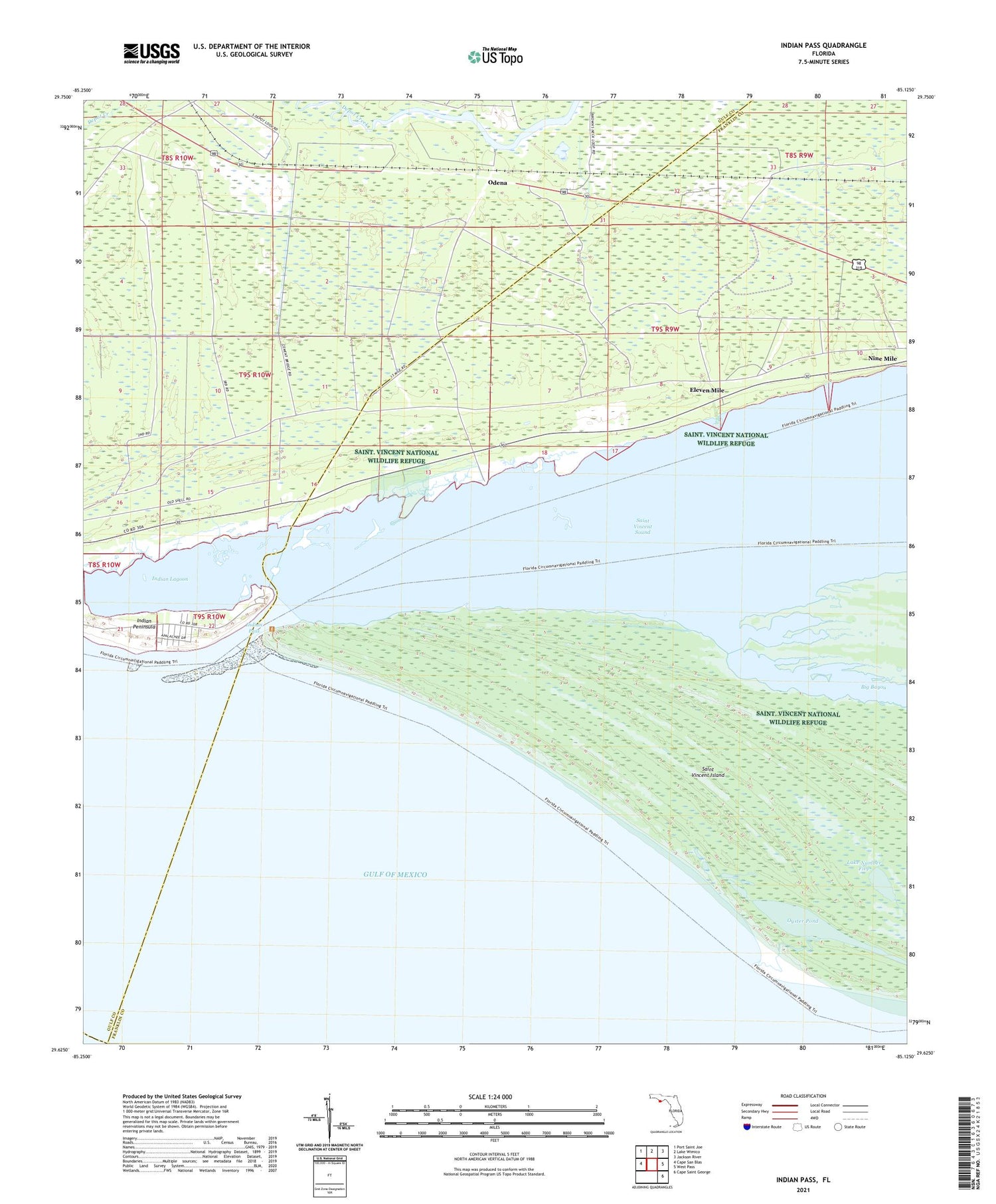
2025 topographic map quadrangle Indian Pass in the state of Florida. Scale: 1:24000. Based on the newly updated USGS 7.5' US Topo map series, this map is in the following counties: Franklin, Gulf. The map contains contour data, water features, and other items you are used to seeing on USGS maps, but also has updated roads and other features. This is the next generation of topographic maps. Printed on high-quality waterproof paper with UV fade-resistant inks.
Quads adjacent to this one:
West: Cape San Blas
Northwest: Port Saint Joe
North: Lake Wimico
Northeast: Jackson River
East: West Pass
Southeast: Cape Saint George
This map covers the same area as the classic USGS quad with code o29085f2.
Contains the following named places: Big Bayou, Eleven Mile, Indian Lagoon, Indian Pass, Indian Peninsula, Lake Number Five, Odena, Odena Fire Tower, Odena Landing, Oyster Pond, Saint Vincent Island, Saint Vincent National Wildlife Refuge, Thirteen Mile