MyTopo
Lake Wimico Florida US Topo Map
Couldn't load pickup availability
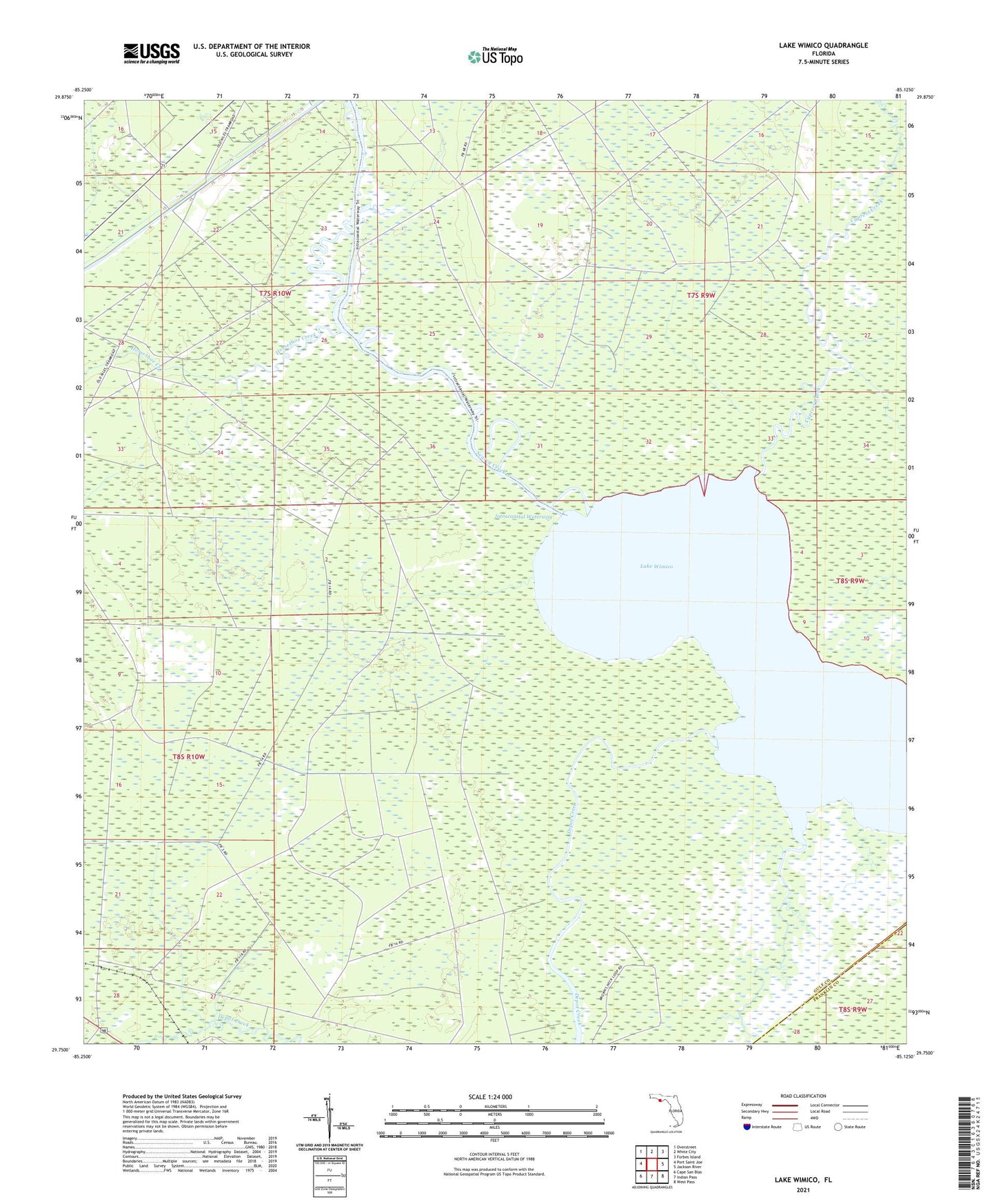
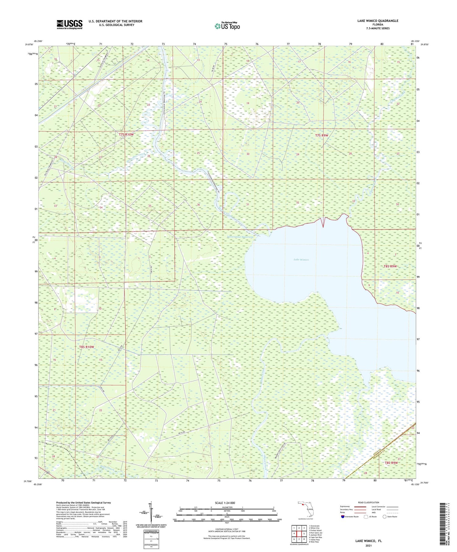
2024 topographic map quadrangle Lake Wimico in the state of Florida. Scale: 1:24000. Based on the newly updated USGS 7.5' US Topo map series, this map is in the following counties: Gulf, Franklin. The map contains contour data, water features, and other items you are used to seeing on USGS maps, but also has updated roads and other features. This is the next generation of topographic maps. Printed on high-quality waterproof paper with UV fade-resistant inks.
Quads adjacent to this one:
West: Port Saint Joe
Northwest: Overstreet
North: White City
Northeast: Forbes Island
East: Jackson River
Southeast: West Pass
South: Indian Pass
Southwest: Cape San Blas
This map covers the same area as the classic USGS quad with code o29085g2.
Contains the following named places: Cypress Creek, Depot Creek, Edward Ball Wildlife Management Area, Horseshoe Creek, Indian Bayou, Lake Wimico, Searcy Creek