
MyTopo
Chassahowitzka Bay Florida US Topo Map
Couldn't load pickup availability
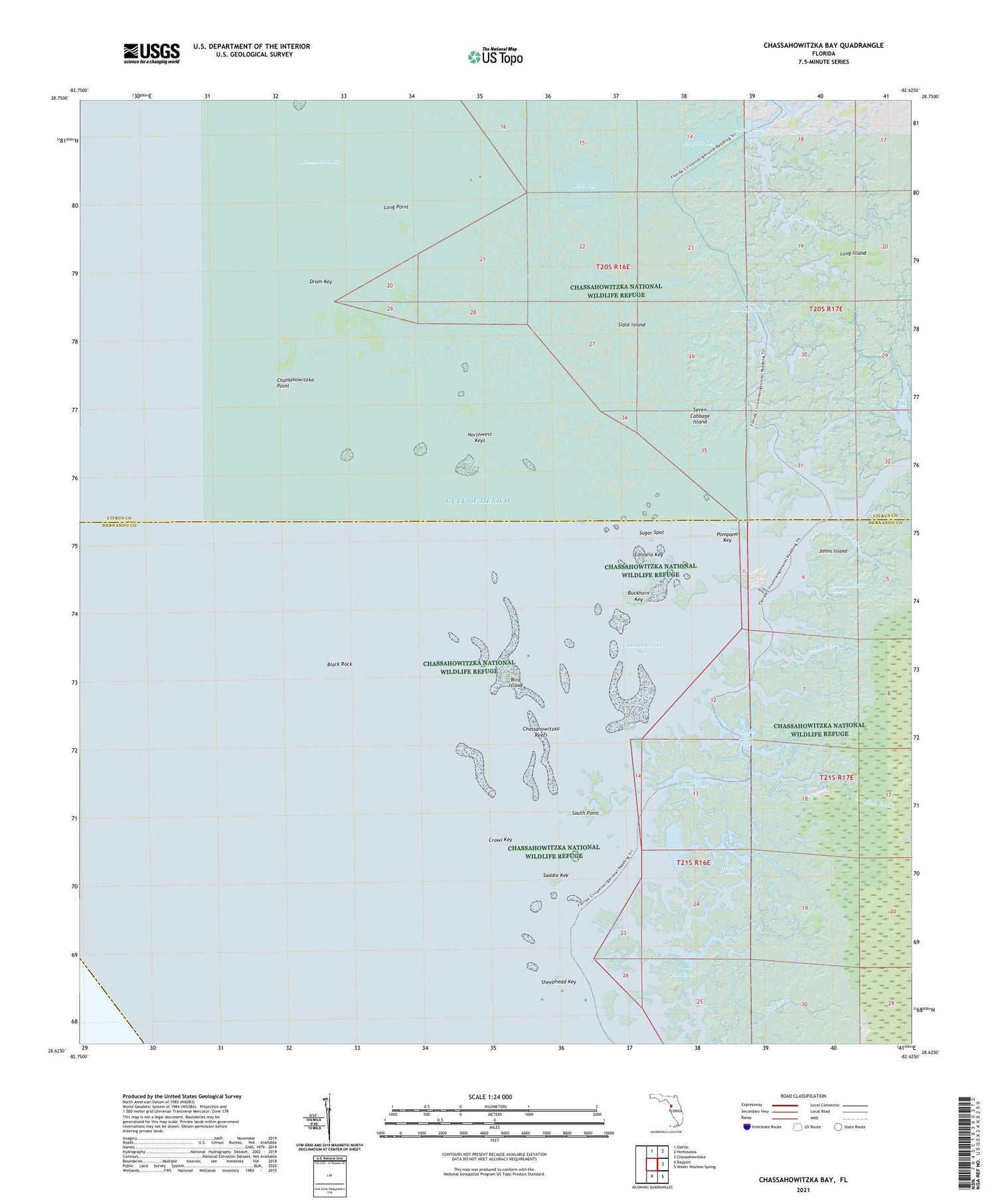
2025 topographic map quadrangle Chassahowitzka Bay in the state of Florida. Scale: 1:24000. Based on the newly updated USGS 7.5' US Topo map series, this map is in the following counties: Hernando, Citrus. The map contains contour data, water features, and other items you are used to seeing on USGS maps, but also has updated roads and other features. This is the next generation of topographic maps. Printed on high-quality waterproof paper with UV fade-resistant inks.
Quads adjacent to this one:
North: Ozello
Northeast: Homosassa
East: Chassahowitzka
Southeast: Weeki Wachee Spring
South: Bayport
This map covers the same area as the classic USGS quad with code o28082f6.
Contains the following named places: Bird Island, Black Rock, Blind Creek, Blue Bay, Buckhorn Key, Camp Creek, Chassahowitzka Bay, Chassahowitzka National Wildlife Refuge, Chassahowitzka Point, Chassahowitzka Reefs, Chassahowitzka River, Chassahowitzka Wilderness, Chub Creek, Colvalia Key, Crawl Key, Custom Commerce Center, Drum Key, Embassy Plaza, Fish Creek, Gator Creek, Haulover Creek, Homosassa Bay, Johns Island, Lone Cabbage Creek, Long Island, Long Point, May Creek, Mud Creek, North Blind Creek, Northwest Keys, Oyster Creek, Pompano Key, Porpoise Bay, Pumpkin Creek, Rose Creek, Saddle Key, Seven Cabbage Cutoff, Seven Cabbage Island, Sheephead Key, Slate Island, South Blind Creek, South Point, Sugar Spot, Twin Creek


