MyTopo
Clara Florida US Topo Map
Couldn't load pickup availability
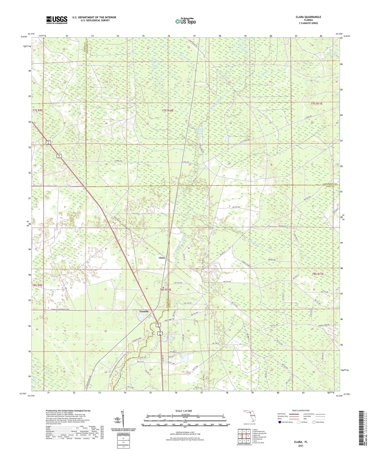
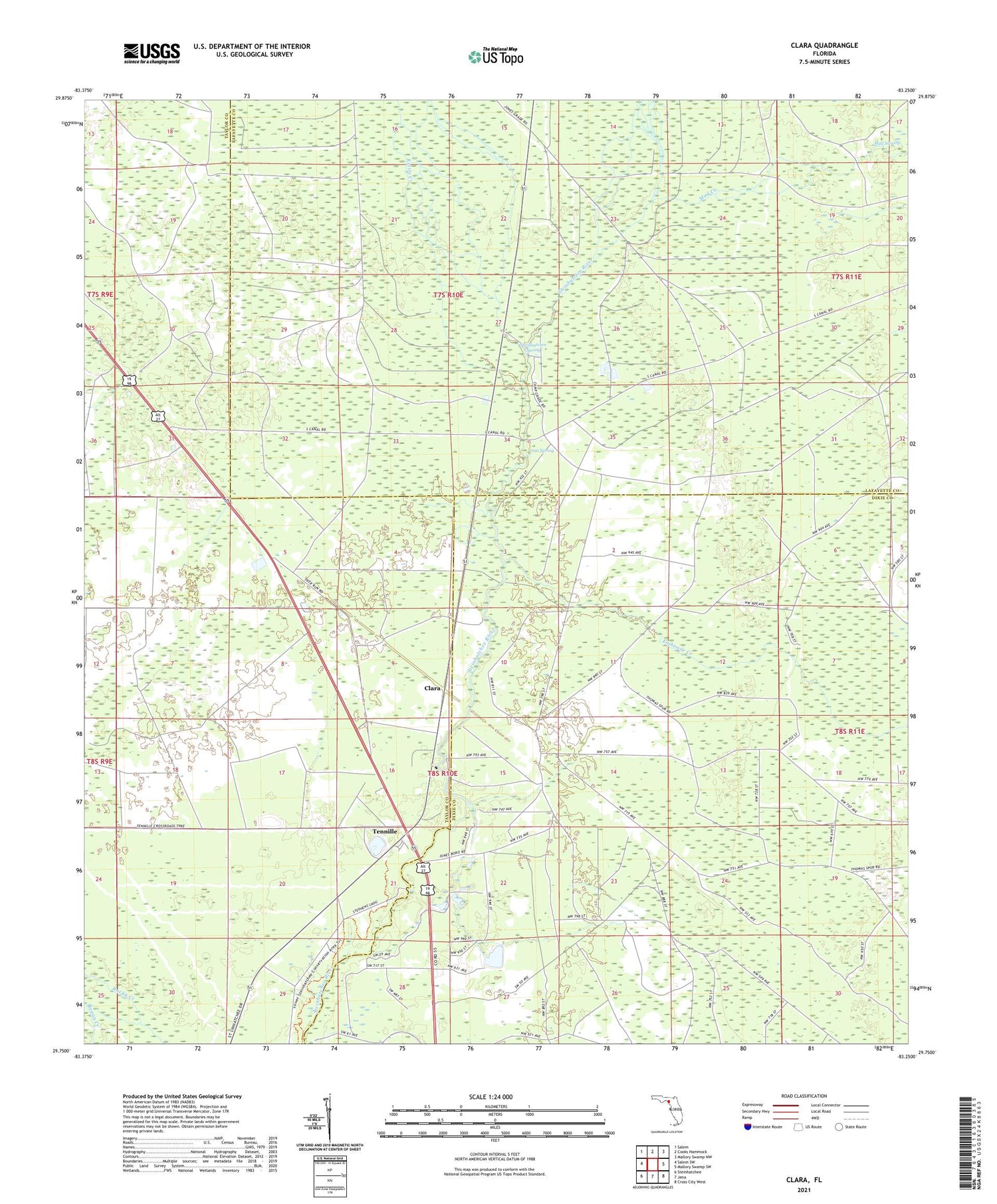
2024 topographic map quadrangle Clara in the state of Florida. Scale: 1:24000. Based on the newly updated USGS 7.5' US Topo map series, this map is in the following counties: Taylor, Dixie, Lafayette. The map contains contour data, water features, and other items you are used to seeing on USGS maps, but also has updated roads and other features. This is the next generation of topographic maps. Printed on high-quality waterproof paper with UV fade-resistant inks.
Quads adjacent to this one:
West: Salem SW
Northwest: Salem
North: Cooks Hammock
Northeast: Mallory Swamp NW
East: Mallory Swamp SW
Southeast: Cross City West
South: Jena
Southwest: Steinhatchee
This map covers the same area as the classic USGS quad with code o29083g3.
Contains the following named places: Clara, Eightmile Creek, Iron Spring, Kettle Creek, Mud Creek, Steinhatchee Spring, Tennille, Wolf Creek