
MyTopo
Steinhatchee Florida US Topo Map
Couldn't load pickup availability
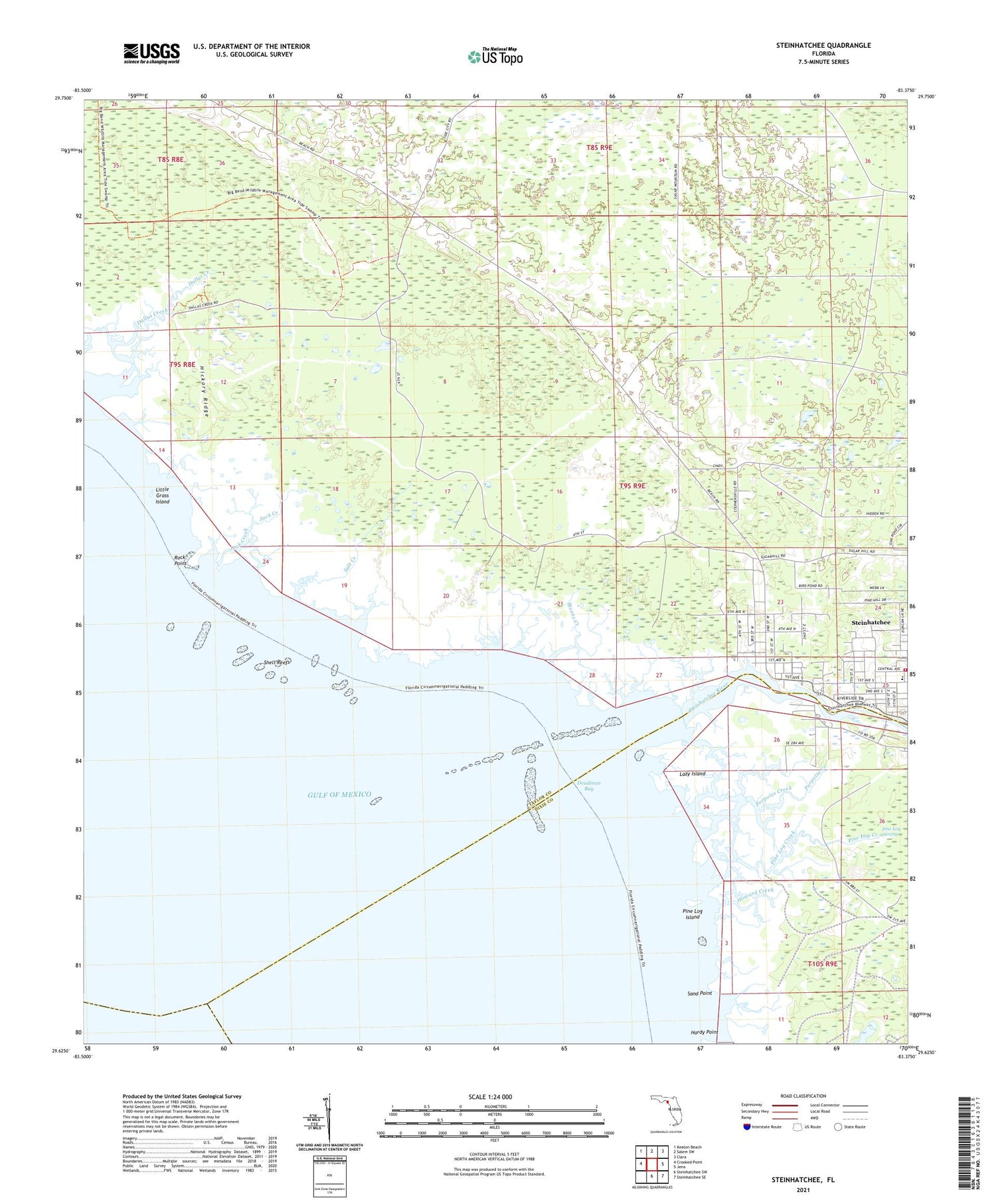
2025 topographic map quadrangle Steinhatchee in the state of Florida. Scale: 1:24000. Based on the newly updated USGS 7.5' US Topo map series, this map is in the following counties: Taylor, Dixie. The map contains contour data, water features, and other items you are used to seeing on USGS maps, but also has updated roads and other features. This is the next generation of topographic maps. Printed on high-quality waterproof paper with UV fade-resistant inks.
Quads adjacent to this one:
West: Crooked Point
Northwest: Keaton Beach
North: Salem SW
Northeast: Clara
East: Jena
Southeast: Steinhatchee SE
South: Steinhatchee SW
This map covers the same area as the classic USGS quad with code o29083f4.
Contains the following named places: Bayview Creek, Bivens Creek, Dallus Creek, Dallus Creek Landing, Deadman Bay, Hickory Ridge, Howard Creek, Jack Creek, Lazy Island, Little Grass Island, Pine Log Creek, Pine Log Island, Porpoise Creek, Rock Point, Salt Creek, Sand Point, Shell Reefs, Steinhatchee, Steinhatchee Census Designated Place, Steinhatchee River, Steinhatchee School, Steinhatchee Volunteer Fire and Rescue, Stewart City, Tide Swamp Wildlife Management Area, ZIP Code: 32359


