
MyTopo
Cooks Hammock Florida US Topo Map
Couldn't load pickup availability
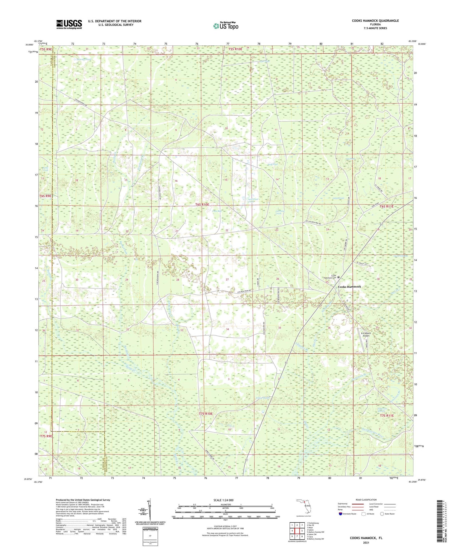
2024 topographic map quadrangle Cooks Hammock in the state of Florida. Scale: 1:24000. Based on the newly updated USGS 7.5' US Topo map series, this map is in the following counties: Lafayette, Taylor. The map contains contour data, water features, and other items you are used to seeing on USGS maps, but also has updated roads and other features. This is the next generation of topographic maps. Printed on high-quality waterproof paper with UV fade-resistant inks.
Quads adjacent to this one:
West: Salem
Northwest: Fenholloway
North: Day SE
Northeast: Mayo
East: Mallory Swamp NW
Southeast: Mallory Swamp SW
South: Clara
Southwest: Salem SW
This map covers the same area as the classic USGS quad with code o29083h3.
Contains the following named places: Alligator Branch, Britt Creek, Carbur Lookout Tower, Cat Pond Creek, Cat Ponds, Cooks Hammock, Cooks Hammock Cemetery, Coon Bay, Crossway Branch, Dowdy Pond, Ever Pond, Kettle Creek, Little Britt Creek, Oaky Heads, Owl Creek, Owl Creek Bay, Patterson Branch, R O Ranch Airport, Reedy Creek, Townsend Creek, Twomile Branch, Willow Slough, Wolf Pond, Wolf Pond Creek


