MyTopo
Lake Poinsett Florida US Topo Map
Couldn't load pickup availability
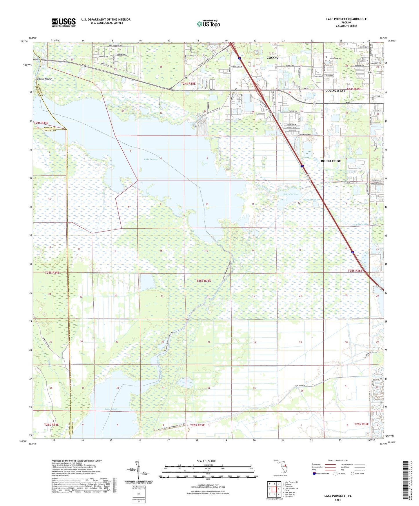
2024 topographic map quadrangle Lake Poinsett in the state of Florida. Scale: 1:24000. Based on the newly updated USGS 7.5' US Topo map series, this map is in the following counties: Brevard, Osceola, Orange. The map contains contour data, water features, and other items you are used to seeing on USGS maps, but also has updated roads and other features. This is the next generation of topographic maps. Printed on high-quality waterproof paper with UV fade-resistant inks.
Quads adjacent to this one:
West: Lake Poinsett SW
Northwest: Lake Poinsett NW
North: Sharpes
Northeast: Courtenay
East: Cocoa
Southeast: Eau Gallie
South: Deer Park NE
Southwest: Deer Park NW
This map covers the same area as the classic USGS quad with code o28080c7.
Contains the following named places: Barnett Lake, Bethel Korean Community Church, Brevard County Fire Rescue Station 44 - 46, Brevard County Sheriff's Office - West Precinct Substation, Cedar Lakes Mobile Home Park, Central Community Church, Church of God of Prophecy, Cocoa Point Park Mobile Home Park, Cocoa Presbyterian Church, Cocoa West Census Designated Place, Cocoa-Rockledge Division, Cox Creek, Cypress Strand Mobile Home Park, Eagle One Mobile Home Park, Florida Highway Patrol Troop D Cocoa Station, Florida Mobile Home Park, Fontana Cove Mobile Home Park, Forest Village Mobile Park, Lake Florence, Lake Poinsett, Lake Winder, Lane Cabbage Camp, Maplewood Village Mobile Home Park, Mulberry Mound, New Hope Deliverance Temple, Parker Memorial Baptist Church, Pine Crest Cemetery, Poinsett Lodge, Poinsett Mobile Home Park, Rockedge Creek, Saturn Elementary School, Tropical Court Mobile Home Park, Twin Oaks Park Mobile Home Park, West Gate Mobile Home Park, WHKR-FM (Rockledge), WLRQ-AM (Cocoa), WMMV - AM (Cocoa), WRES-TV (Cocoa), WWBC-AM (Rockledge), WWKO-AM (Cocoa), WXXU-AM (Cocoa Beach)