
MyTopo
Deep Lake Florida US Topo Map
Couldn't load pickup availability
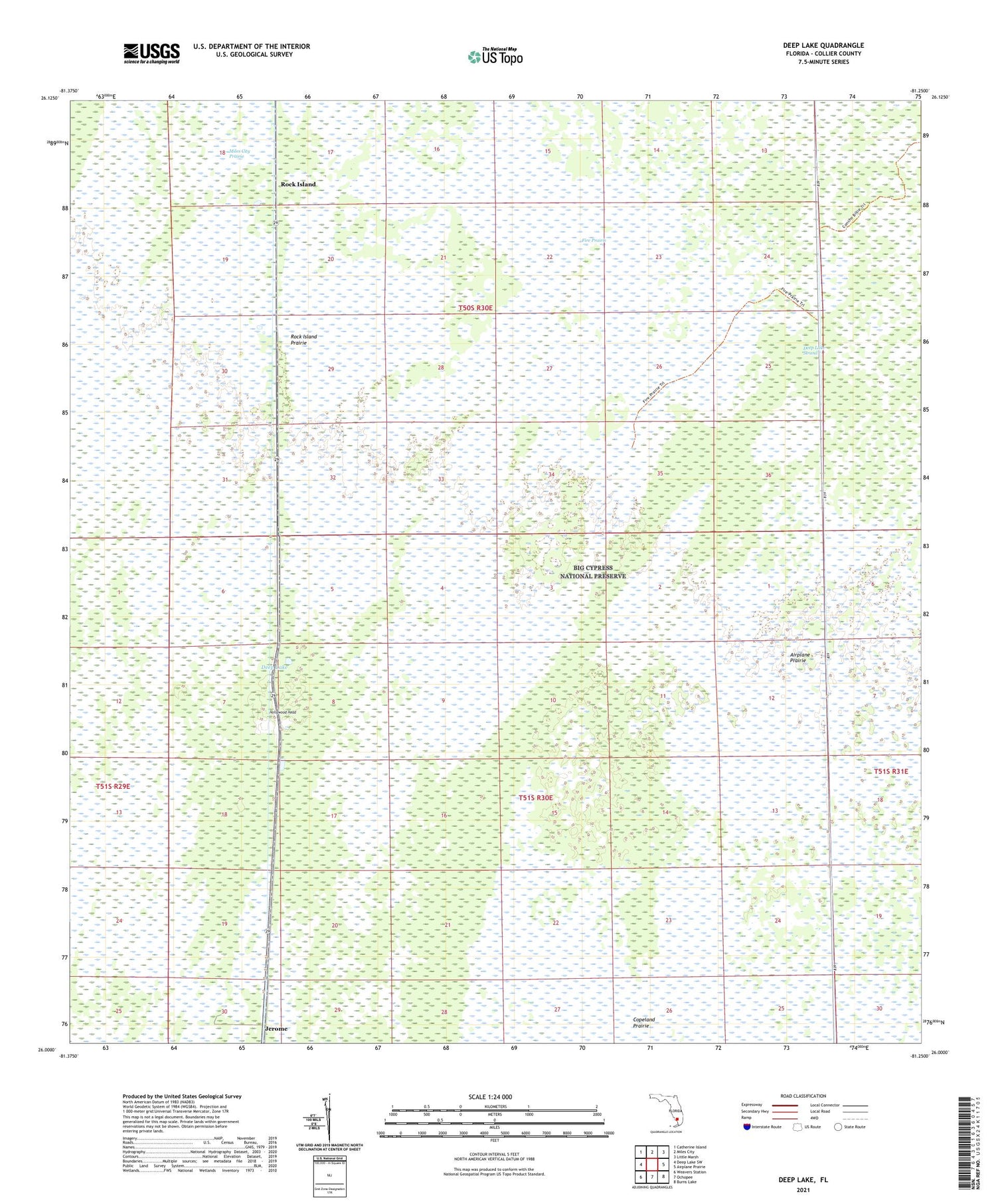
2024 topographic map quadrangle Deep Lake in the state of Florida. Scale: 1:24000. Based on the newly updated USGS 7.5' US Topo map series, this map is in the following counties: Collier. The map contains contour data, water features, and other items you are used to seeing on USGS maps, but also has updated roads and other features. This is the next generation of topographic maps. Printed on high-quality waterproof paper with UV fade-resistant inks.
Quads adjacent to this one:
West: Deep Lake SW
Northwest: Catherine Island
North: Miles City
Northeast: Little Marsh
East: Airplane Prairie
Southeast: Burns Lake
South: Ochopee
Southwest: Weavers Station
This map covers the same area as the classic USGS quad with code o26081a3.
Contains the following named places: Airplane Prairie, Deep Lake, Deep Lake Strand, Fire Prairie, Holden Park Brethren in Christ Church, Hollywood Head, Matmon Railroad Station, Rock Island, Rock Island Prairie


