
MyTopo
Deep Lake SW Florida US Topo Map
Couldn't load pickup availability
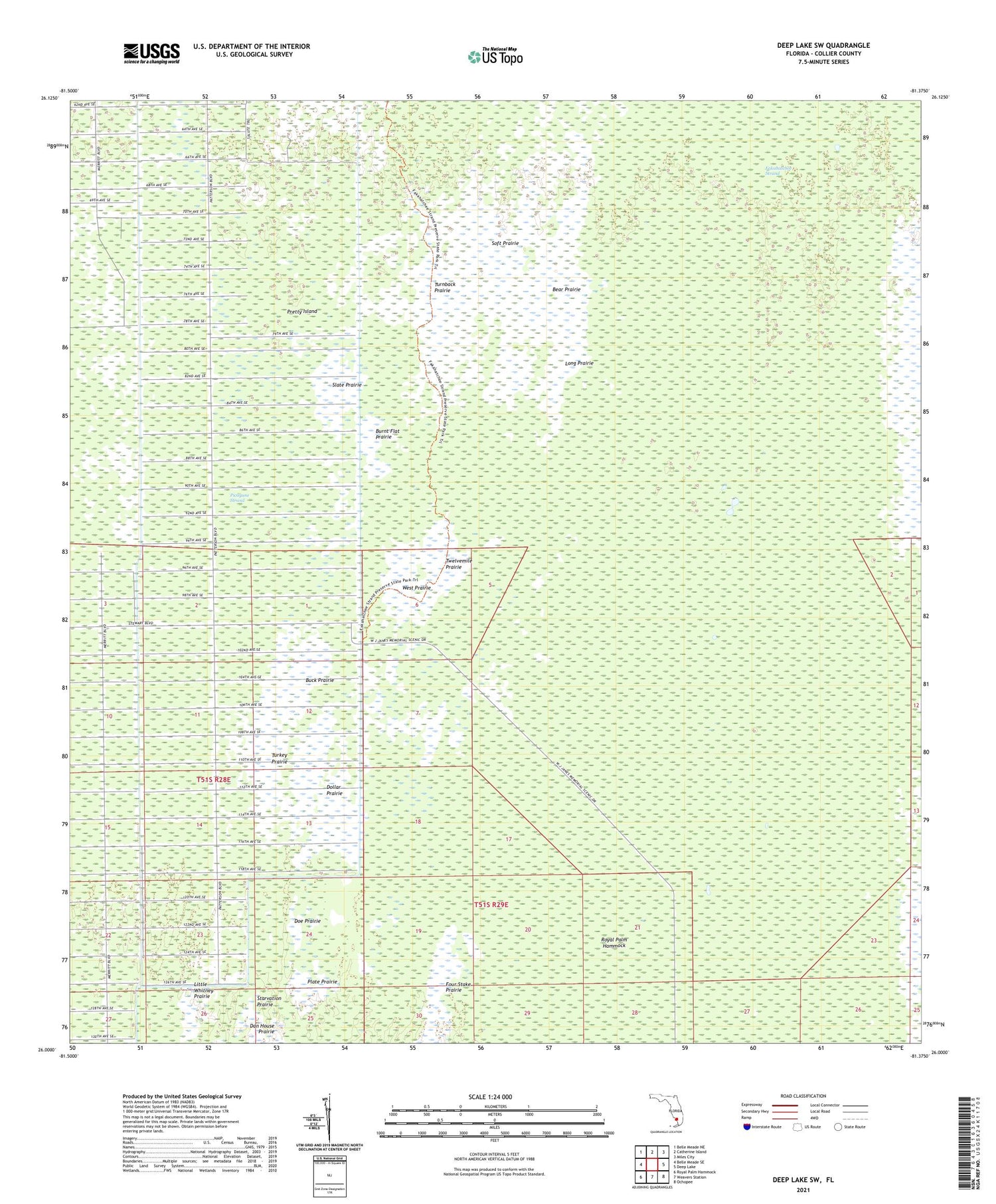
2024 topographic map quadrangle Deep Lake SW in the state of Florida. Scale: 1:24000. Based on the newly updated USGS 7.5' US Topo map series, this map is in the following counties: Collier. The map contains contour data, water features, and other items you are used to seeing on USGS maps, but also has updated roads and other features. This is the next generation of topographic maps. Printed on high-quality waterproof paper with UV fade-resistant inks.
Quads adjacent to this one:
West: Belle Meade SE
Northwest: Belle Meade NE
North: Catherine Island
Northeast: Miles City
East: Deep Lake
Southeast: Ochopee
South: Weavers Station
Southwest: Royal Palm Hammock
This map covers the same area as the classic USGS quad with code o26081a4.
Contains the following named places: Bear Prairie, Buck Prairie, Burnt Flat Prairie, Collier County, Doe Prairie, Dollar Prairie, Fakahatchee Strand, Fakahatchee Strand Preserve State Park, Little Whitney Prairie, Long Prairie, Picayune Strand, Plate Prairie, Pretty Island, Royal Palm Hammock, Slate Prairie, Soft Prairie, Starvation Prairie, Turkey Prairie, Turnback Prairie, Twelvemile Prairie, West Prairie


