
MyTopo
Royal Palm Hammock Florida US Topo Map
Couldn't load pickup availability
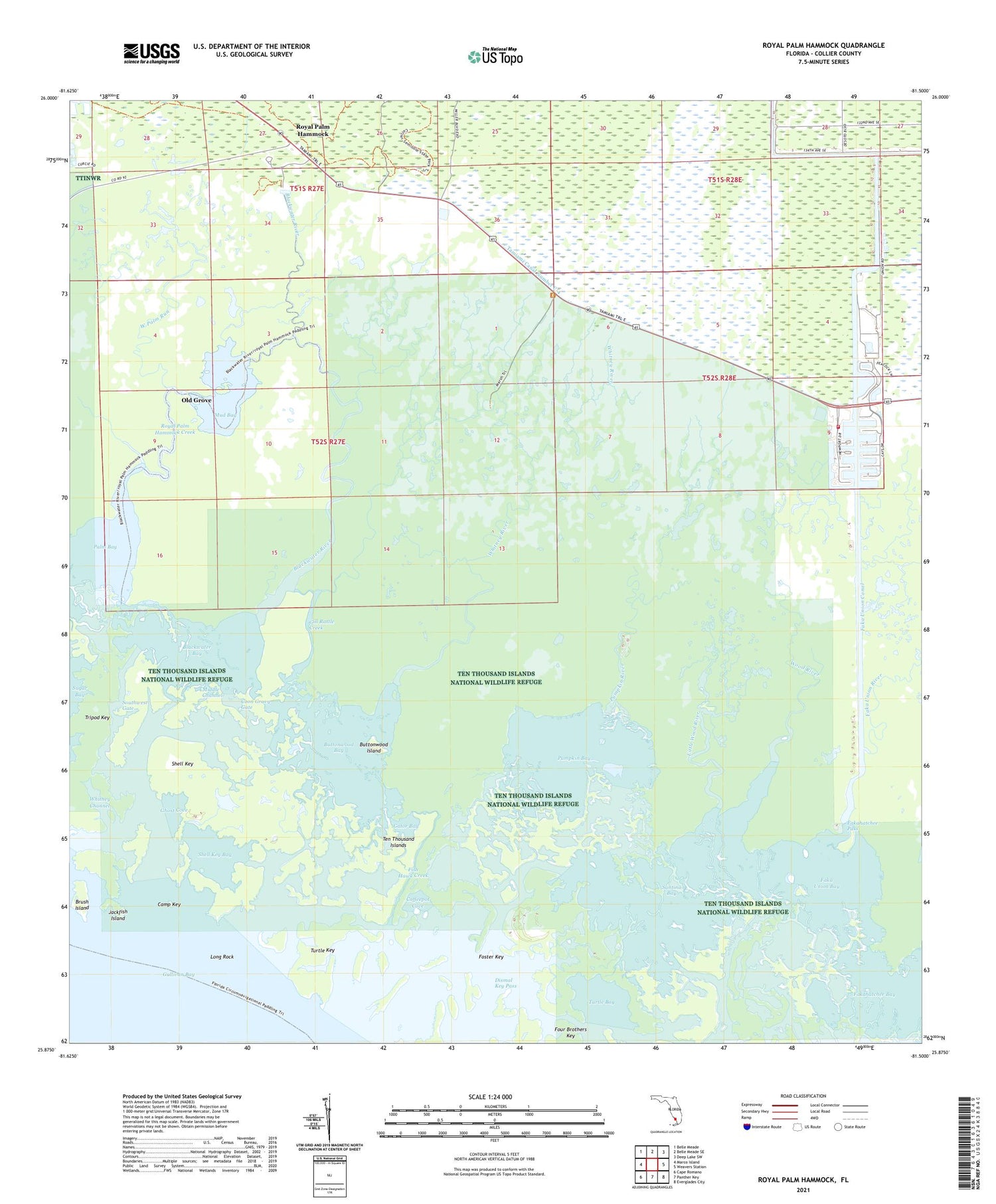
2025 topographic map quadrangle Royal Palm Hammock in the state of Florida. Scale: 1:24000. Based on the newly updated USGS 7.5' US Topo map series, this map is in the following counties: Collier. The map contains contour data, water features, and other items you are used to seeing on USGS maps, but also has updated roads and other features. This is the next generation of topographic maps. Printed on high-quality waterproof paper with UV fade-resistant inks.
Quads adjacent to this one:
West: Marco Island
Northwest: Belle Meade
North: Belle Meade SE
Northeast: Deep Lake SW
East: Weavers Station
Southeast: Everglades City
South: Panther Key
Southwest: Cape Romano
This map covers the same area as the classic USGS quad with code o25081h5.
Contains the following named places: Blackwater Bay, Blackwater River, Brush Island, Buttonwood Bay, Buttonwood Island, Camp Key, Coffeepot Cove, Collier-Seminole State Park, Coon Gravy Gate, Dismal Key, Dismal Key Pass, Faka Union Bay, Faka Union Canal, Fakahatchee Pass, Fish Hawk Creek, Foster Key, Four Brothers Key, Gator Bay, Ghost Cove, Gill Rattle Creek, Grocery Place, Jackfish Island, Little Wood River, Long Rock, Maroco Lookout Tower, Middle Channel, Mud Bay, Old Grove, Palm Bay, Port of the Islands Airport, Pumpkin Bay, Pumpkin River, Remuda Ranch, Royal Palm Hammock, Royal Palm Hammock Creek, Santina Bay, Shell Key, Shell Key Bay, Southwest Gate, Ten Thousand Islands National Wildlife Refuge, Turtle Bay, Turtle Key, West Palm Run, Whitney Channel, Whitney River, WMIB-AM (Marco Island), Wood River, ZIP Code: 34114


