
MyTopo
East Pass Florida US Topo Map
Couldn't load pickup availability
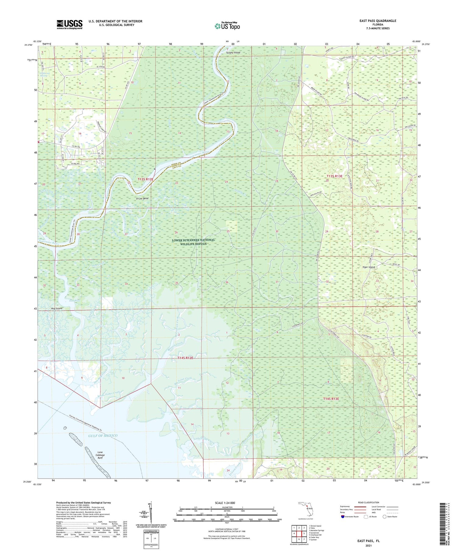
2025 topographic map quadrangle East Pass in the state of Florida. Scale: 1:24000. Based on the newly updated USGS 7.5' US Topo map series, this map is in the following counties: Levy, Dixie. The map contains contour data, water features, and other items you are used to seeing on USGS maps, but also has updated roads and other features. This is the next generation of topographic maps. Printed on high-quality waterproof paper with UV fade-resistant inks.
Quads adjacent to this one:
West: Suwannee
Northwest: Shired Island
North: Vista
Northeast: Manatee Springs
East: Chiefland SW
Southeast: Sumner
South: Cedar Key
This map covers the same area as the classic USGS quad with code o29083c1.
Contains the following named places: Barnett Creek, Beech Creek, Big Trout Creek, Bull Creek, Dan May Creek, Dead Boy Creek, Dixie County Fire and Rescue Station 71, East Pass, Flag Creek, Fletcher Landing, Gopher River, Little Trout Creek, McCormick Creek, Monden Creek, Pitt Creek, Raulerson Creek, Ridgeway Creek, Sand Creek, Sandfly Creek, Shingle Creek, Tiger Island, Turkey Creek, Turkey Island, U-Lee Bend, Weeks Fisher Creek, Wisher Creek, ZIP Code: 32692


