MyTopo
Sumner Florida US Topo Map
Couldn't load pickup availability
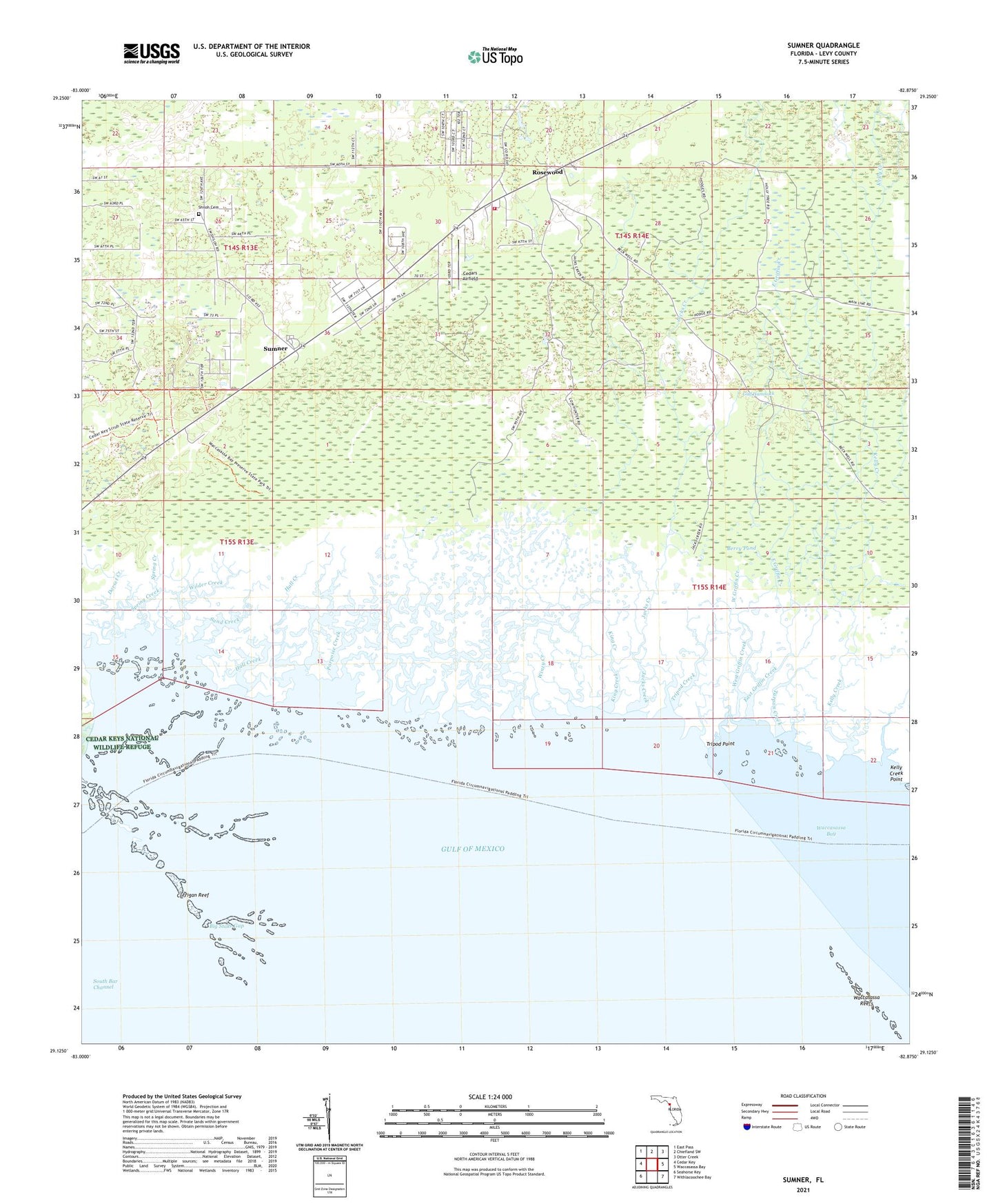
2025 topographic map quadrangle Sumner in the state of Florida. Scale: 1:24000. Based on the newly updated USGS 7.5' US Topo map series, this map is in the following counties: Levy. The map contains contour data, water features, and other items you are used to seeing on USGS maps, but also has updated roads and other features. This is the next generation of topographic maps. Printed on high-quality waterproof paper with UV fade-resistant inks.
Quads adjacent to this one:
West: Cedar Key
Northwest: East Pass
North: Chiefland SW
Northeast: Otter Creek
East: Waccasassa Bay
Southeast: Withlacoochee Bay
Southwest: Seahorse Key
This map covers the same area as the classic USGS quad with code o29082b8.
Contains the following named places: Berry Pond, Big Stake Gap, Cedar Key-Yankeetown Division, Cedars Airfield, Corrigan Reef, Dorset Creek, East Griffin Creek, Hall Creek, Jacks Creek, Kelly Creek, Kelly Creek Point, King Creek, Porpoise Creek, Rosewood, Rosewood Volunteer Fire Department, Sand Creek, Shiloh Cemetery, South Bar Channel, Spring Creek, Sumner, Suwannee Lookout Tower, Tarpon Creek, Tripod Creek, Tripod Point, West Griffin Creek, Wilder Creek, Winzy Creek