MyTopo
Eugene Florida US Topo Map
Couldn't load pickup availability
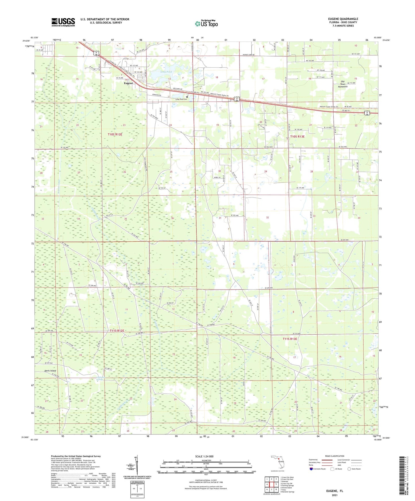
2024 topographic map quadrangle Eugene in the state of Florida. Scale: 1:24000. Based on the newly updated USGS 7.5' US Topo map series, this map is in the following counties: Dixie. The map contains contour data, water features, and other items you are used to seeing on USGS maps, but also has updated roads and other features. This is the next generation of topographic maps. Printed on high-quality waterproof paper with UV fade-resistant inks.
Quads adjacent to this one:
West: Cross City SW
Northwest: Cross City West
North: Cross City East
Northeast: Wannee
East: Fanning Springs
Southeast: Manatee Springs
South: Vista
Southwest: Shired Island
This map covers the same area as the classic USGS quad with code o29083e1.
Contains the following named places: Airport Canal, Brunco Railroad Station, Dixie County High School, Eugene, Long Pond, Long Pond Cemetery, Prospect Church