MyTopo
Felda NE Florida US Topo Map
Couldn't load pickup availability
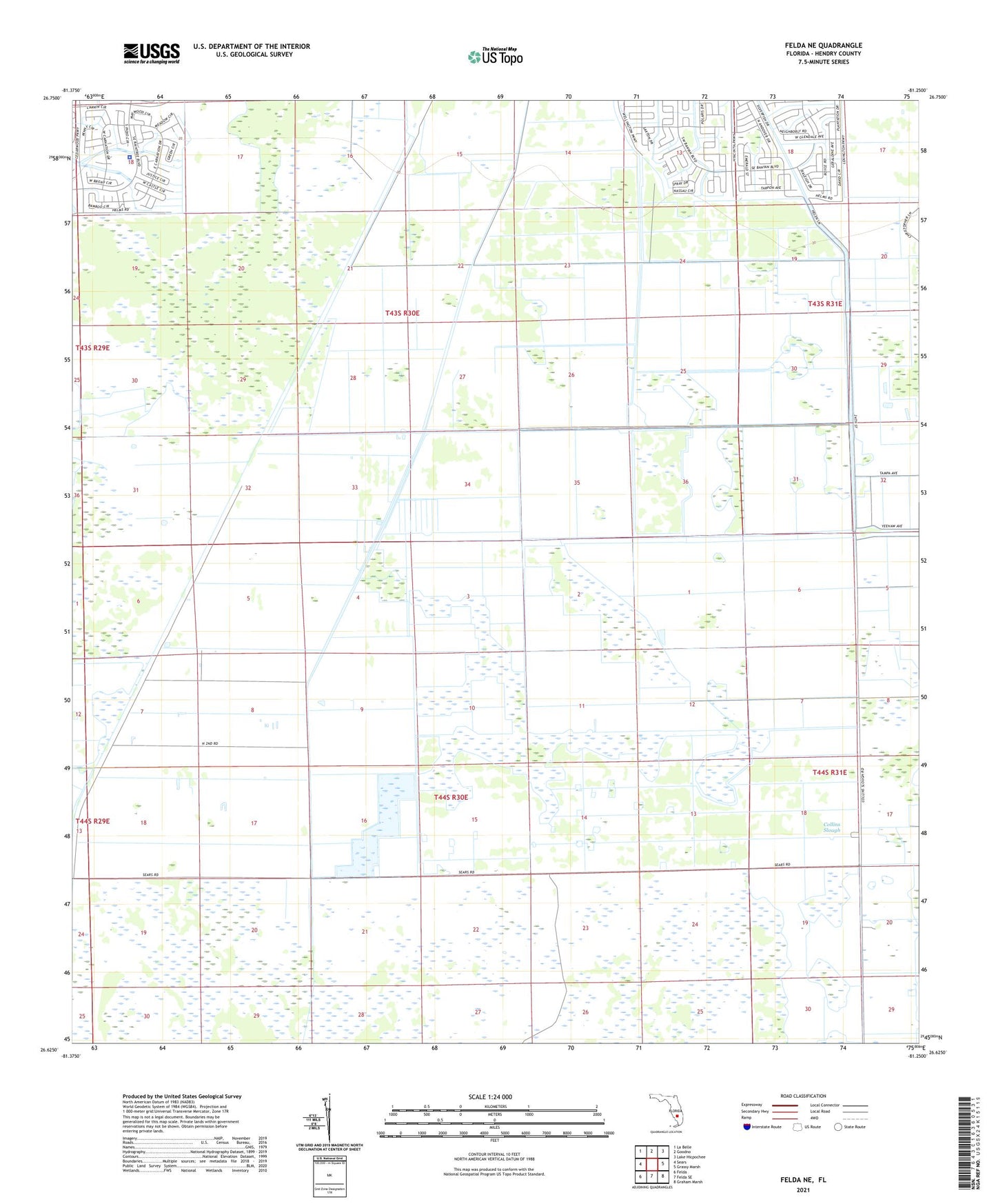
2024 topographic map quadrangle Felda NE in the state of Florida. Scale: 1:24000. Based on the newly updated USGS 7.5' US Topo map series, this map is in the following counties: Hendry. The map contains contour data, water features, and other items you are used to seeing on USGS maps, but also has updated roads and other features. This is the next generation of topographic maps. Printed on high-quality waterproof paper with UV fade-resistant inks.
Quads adjacent to this one:
West: Sears
Northwest: La Belle
North: Goodno
Northeast: Lake Hicpochee
East: Grassy Marsh
Southeast: Graham Marsh
South: Felda SE
Southwest: Felda
This map covers the same area as the classic USGS quad with code o26081f3.
Contains the following named places: Collins Slough, Hendry County Sheriff's Office - Port LaBelle Annex