MyTopo
Fiftone Florida US Topo Map
Couldn't load pickup availability
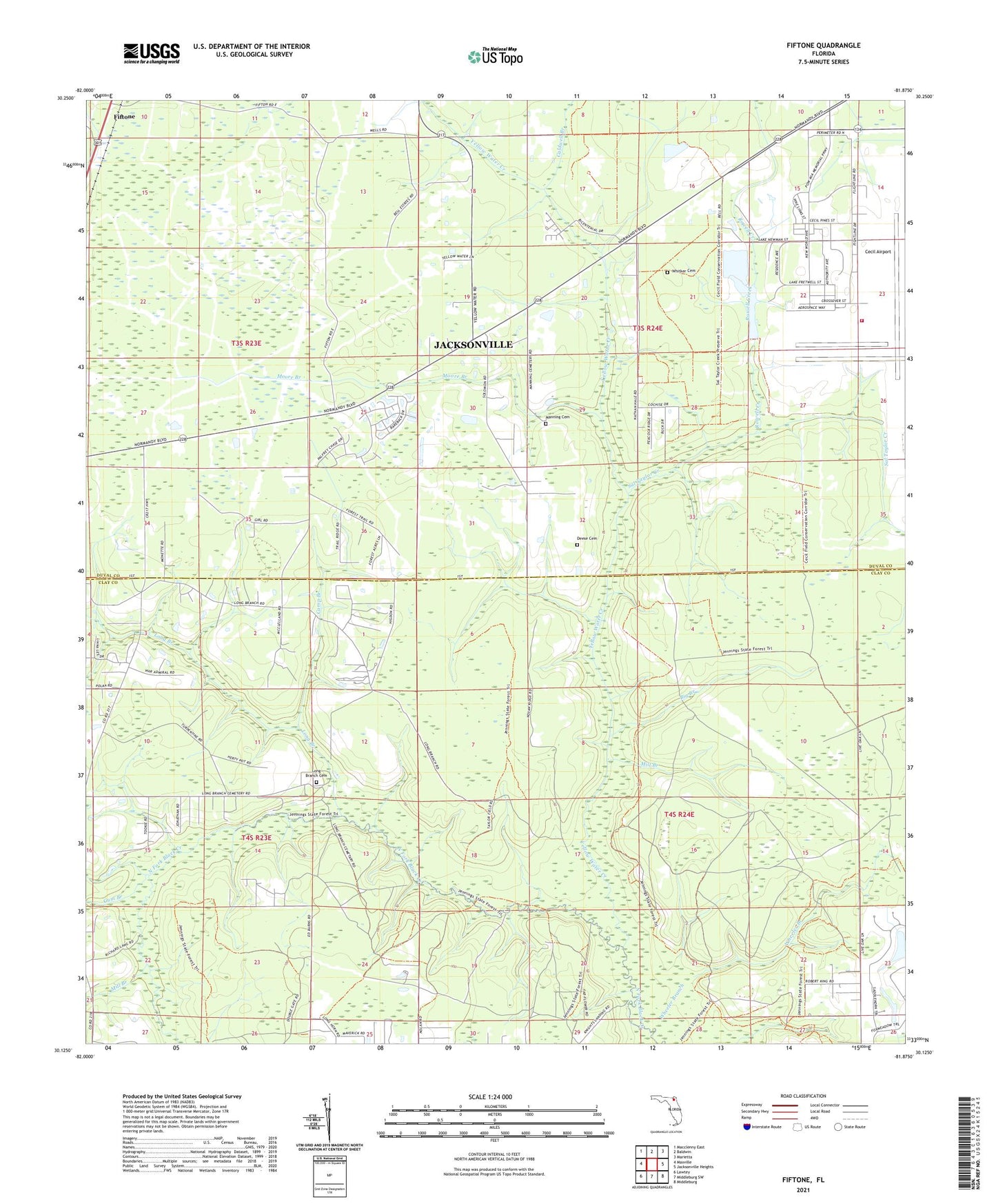
2024 topographic map quadrangle Fiftone in the state of Florida. Scale: 1:24000. Based on the newly updated USGS 7.5' US Topo map series, this map is in the following counties: Clay, Duval. The map contains contour data, water features, and other items you are used to seeing on USGS maps, but also has updated roads and other features. This is the next generation of topographic maps. Printed on high-quality waterproof paper with UV fade-resistant inks.
Quads adjacent to this one:
West: Maxville
Northwest: Macclenny East
North: Baldwin
Northeast: Marietta
East: Jacksonville Heights
Southeast: Middleburg
South: Middleburg SW
Southwest: Lawtey
This map covers the same area as the classic USGS quad with code o30081b8.
Contains the following named places: Big Branch, Caldwell Branch, Camp Branch, Cecil Airport, Deese Cemetery, Fiftone, Fretwell Park, Gum Branch, Jacksonville Fire and Rescue Department Station 56, Lake Fretwell, Lake Newman, Long Branch, Long Branch Cemetery, Long Branch Church, Manning Cemetery, Mill Branch, Moore Branch, Mount Zion Church, POW/MIA Memorial Park, Rowell Creek, Sal Taylor Creek, Wheeler Branch, Whitker Cemetery, Yellow Water Creek, ZIP Code: 32234