MyTopo
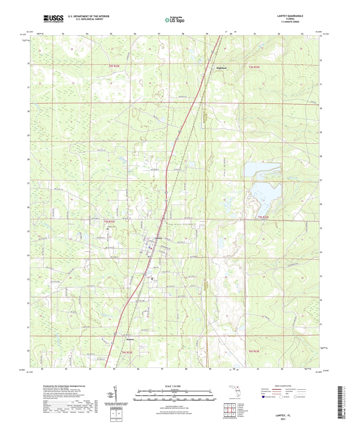
Lawtey Florida US Topo Map
Couldn't load pickup availability
2024 topographic map quadrangle Lawtey in the state of Florida. Scale: 1:24000. Based on the newly updated USGS 7.5' US Topo map series, this map is in the following counties: Bradford, Clay. The map contains contour data, water features, and other items you are used to seeing on USGS maps, but also has updated roads and other features. This is the next generation of topographic maps. Printed on high-quality waterproof paper with UV fade-resistant inks.
Quads adjacent to this one:
West: Raiford
Northwest: Manning
North: Maxville
Northeast: Fiftone
East: Middleburg SW
Southeast: Kingsley
South: Starke
Southwest: Sampson
This map covers the same area as the classic USGS quad with code o30082a1.
Contains the following named places: Anderson School, City of Lawtey, Faith Baptist Church of Lawtey, Highland, Hill Lookout Tower, Lawtey, Lawtey Cemetery, Lawtey Correctional Institution, Lawtey Division, Lawtey Elementary School, Lawtey Fire Rescue Station, Lawtey Police Department, Lawtey Post Office, Louis Hill Lookout Tower, Philadelphia Missionary Baptist Church, Saxton, Saxton Post Office, Trail Ridge, ZIP Code: 32058