MyTopo
Middleburg SW Florida US Topo Map
Couldn't load pickup availability
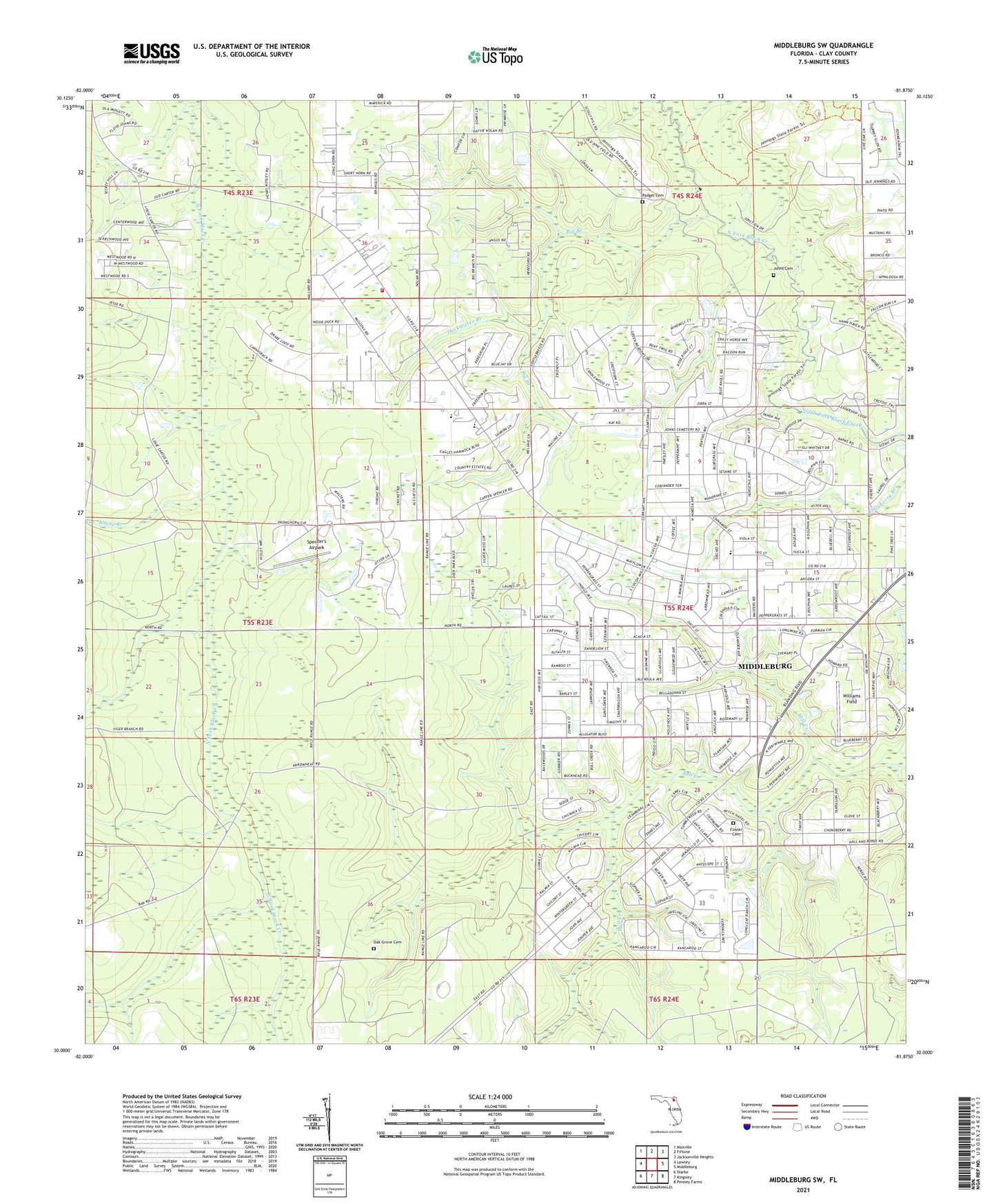
2024 topographic map quadrangle Middleburg SW in the state of Florida. Scale: 1:24000. Based on the newly updated USGS 7.5' US Topo map series, this map is in the following counties: Clay. The map contains contour data, water features, and other items you are used to seeing on USGS maps, but also has updated roads and other features. This is the next generation of topographic maps. Printed on high-quality waterproof paper with UV fade-resistant inks.
Quads adjacent to this one:
West: Lawtey
Northwest: Maxville
North: Fiftone
Northeast: Jacksonville Heights
East: Middleburg
Southeast: Penney Farms
South: Kingsley
Southwest: Starke
This map covers the same area as the classic USGS quad with code o30081a8.
Contains the following named places: Big Branch, Boggy Branch, Bull Creek, Church of God, Cinnamon Street Church, Clay County Fire Rescue Station 13 - Clay Hill, Clay Hill Church of God, Duckwater Branch, First Assembly of God Church, Fowler Cemetery, Freedom Church, Johns Cemetery, Middleburg Census Designated Place, Middleburg Church of Christ, Middleburg-Clay Hill Division, Mill Creek, North Florida Christian Academy, Oak Grove Cemetery, Oak Grove Church, Padget Cemetery, Saint Mark Church, Saint Mark Missionary Baptist Church, Spencer's Airpark, The Church of Jesus Christ of Latter Day Saints, The Jesus Church, Wilkinson Junior High School, Williams Field, ZIP Code: 32068