
MyTopo
Flamingo Florida US Topo Map
Couldn't load pickup availability
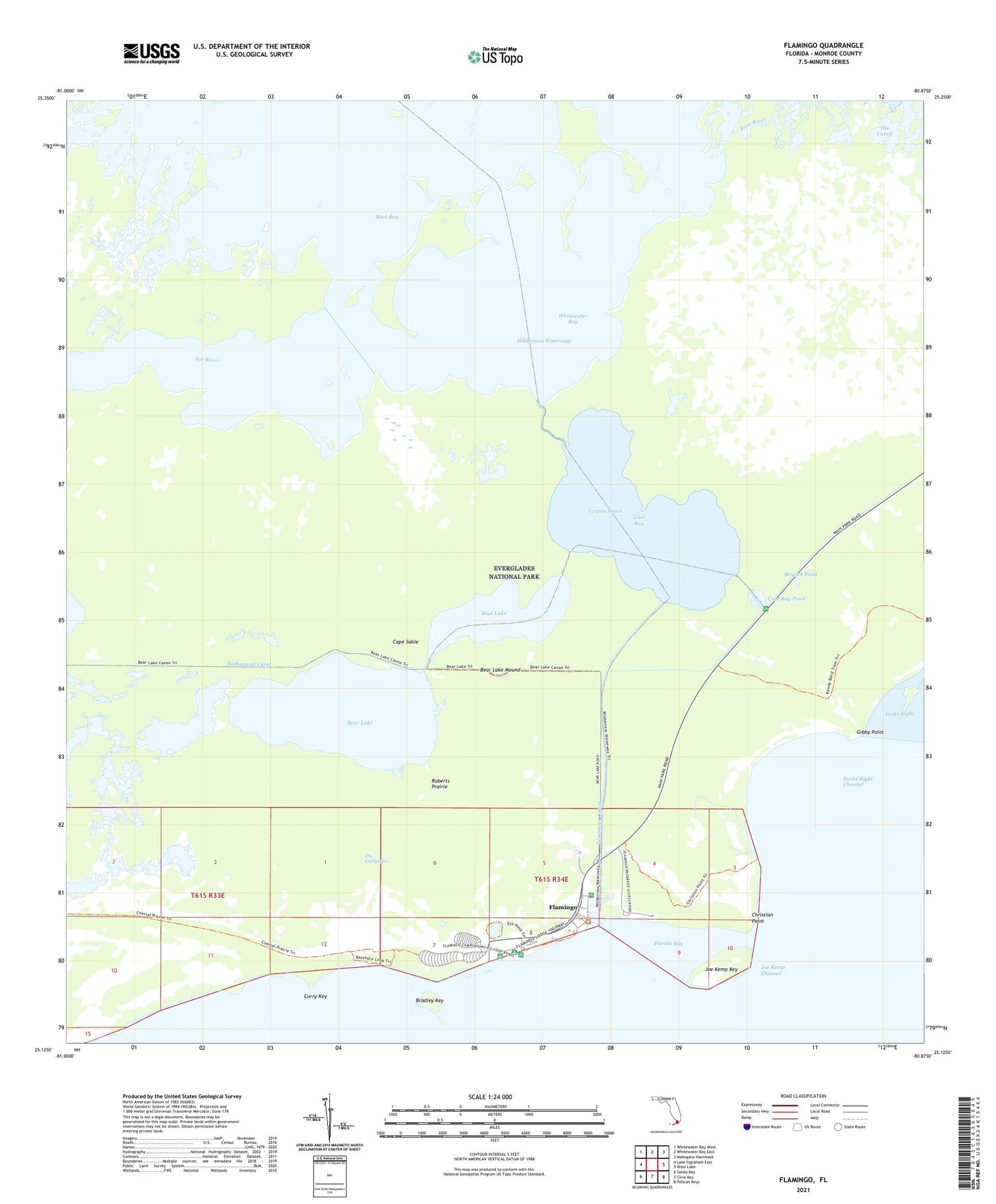
2024 topographic map quadrangle Flamingo in the state of Florida. Scale: 1:24000. Based on the newly updated USGS 7.5' US Topo map series, this map is in the following counties: Monroe. The map contains contour data, water features, and other items you are used to seeing on USGS maps, but also has updated roads and other features. This is the next generation of topographic maps. Printed on high-quality waterproof paper with UV fade-resistant inks.
Quads adjacent to this one:
West: Lake Ingraham East
Northwest: Whitewater Bay West
North: Whitewater Bay East
Northeast: Mahogany Hammock
East: West Lake
Southeast: Pelican Keys
South: Clive Key
Southwest: Sandy Key
This map covers the same area as the classic USGS quad with code o25080b8.
Contains the following named places: Bear Lake, Bear Lake Mound, Bear Lake Trail, Bradley Key, Christian Point, Christian Point Trail, Coastal Prairie Trail, Coot Bay, Coot Bay Pond, Curry Key, East River, Flamingo, Flamingo Campground, Flamingo Canal, Flamingo Ranger Station, Flamingo Sewage Treatment Plant, Gibby Point, Homestead Canal, Joe Kemp Key, Joe River, Mrazek Pond, Mud Lake, Nomans River, Roberts Prairie, Snake Bight Channel, Tarpon Creek


