
MyTopo
Whitewater Bay East Florida US Topo Map
Couldn't load pickup availability
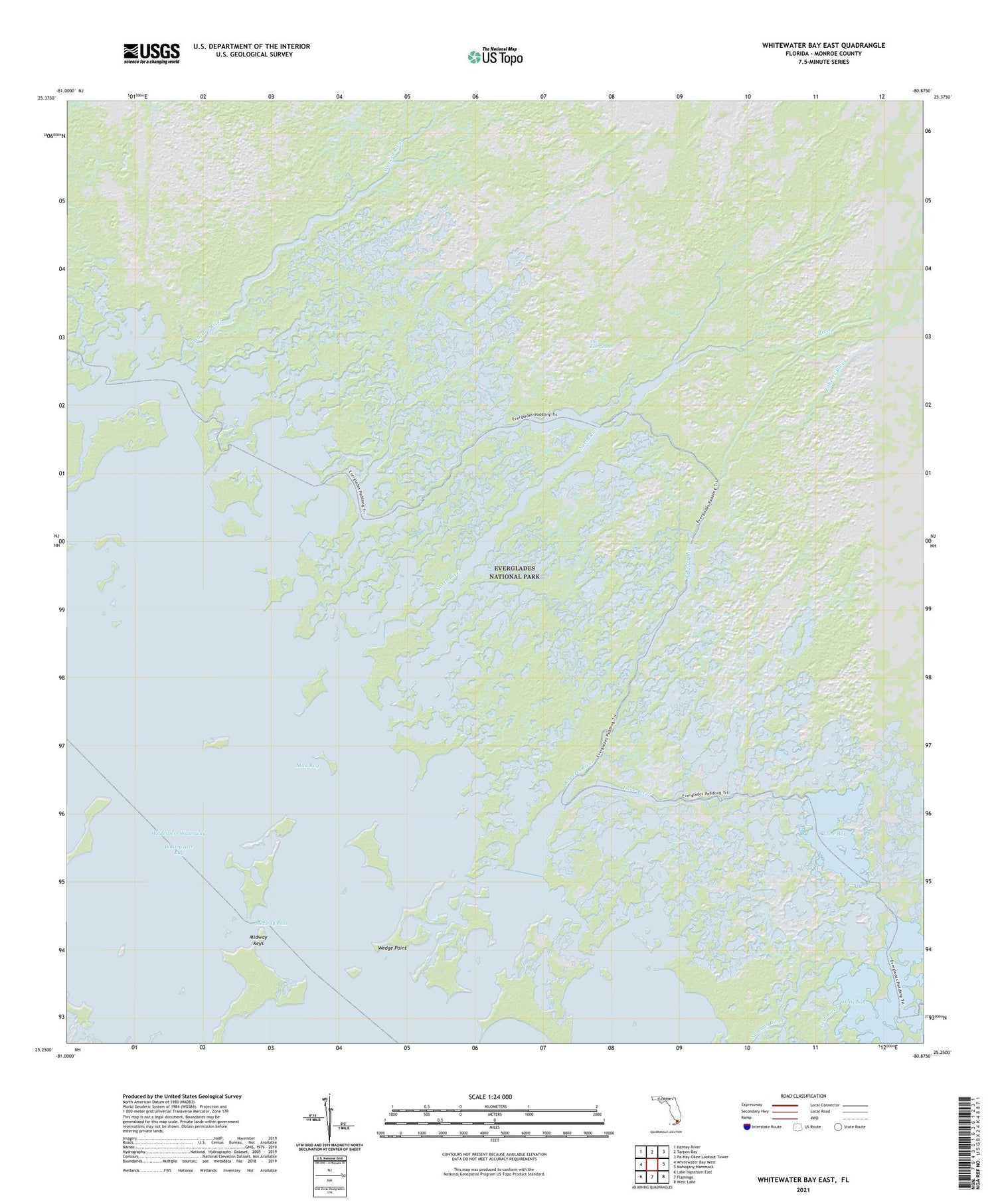
2024 topographic map quadrangle Whitewater Bay East in the state of Florida. Scale: 1:24000. Based on the newly updated USGS 7.5' US Topo map series, this map is in the following counties: Monroe. The map contains contour data, water features, and other items you are used to seeing on USGS maps, but also has updated roads and other features. This is the next generation of topographic maps. Printed on high-quality waterproof paper with UV fade-resistant inks.
Quads adjacent to this one:
West: Whitewater Bay West
Northwest: Harney River
North: Tarpon Bay
Northeast: Pa-Hay-Okee Lookout Tower
East: Mahogany Hammock
Southeast: West Lake
South: Flamingo
Southwest: Lake Ingraham East
This map covers the same area as the classic USGS quad with code o25080c8.
Contains the following named places: Hells Bay, Lane Bay, Lane River, Marjory Stoneman Douglas Wilderness, Midway Keys, Midway Pass, Mud Bay, North River, Roberts River, Watson River, Wedge Point, Whitewater Bay


