
MyTopo
West Lake Florida US Topo Map
Couldn't load pickup availability
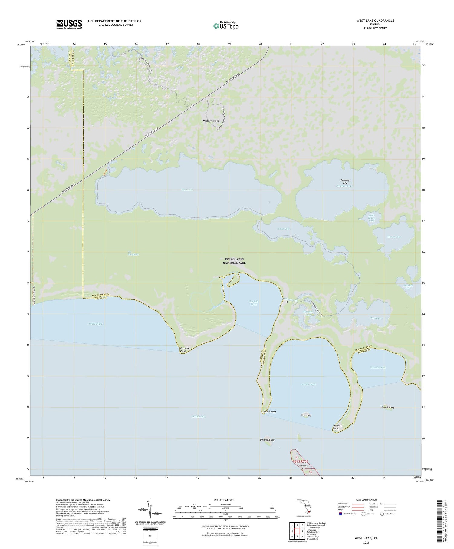
2024 topographic map quadrangle West Lake in the state of Florida. Scale: 1:24000. Based on the newly updated USGS 7.5' US Topo map series, this map is in the following counties: Miami-Dade, Monroe. The map contains contour data, water features, and other items you are used to seeing on USGS maps, but also has updated roads and other features. This is the next generation of topographic maps. Printed on high-quality waterproof paper with UV fade-resistant inks.
Quads adjacent to this one:
West: Flamingo
Northwest: Whitewater Bay East
North: Mahogany Hammock
Northeast: Taylor Slough
East: Madeira Bay
Southeast: Calusa Keys
South: Pelican Keys
Southwest: Clive Key
This map covers the same area as the classic USGS quad with code o25080b7.
Contains the following named places: Alligator Creek, Crocodile Point Trail, Cuthbert Lake, Derelict Key, Garfield Bight, Henry Lake, Little Henry Lake, Long Lake, Mosquito Point, Noble Hammock, Noble Hammock Canoe Trail, Otter Key, Porpoise Point, Rankin Bight, Rankin Key, Rookery Key, Santini Bight, Shark Point, Snake Bight, Snake Bight Canal, The Lungs, Umbrella Key, West Lake


