MyTopo
Fort Walton Beach Florida US Topo Map
Couldn't load pickup availability
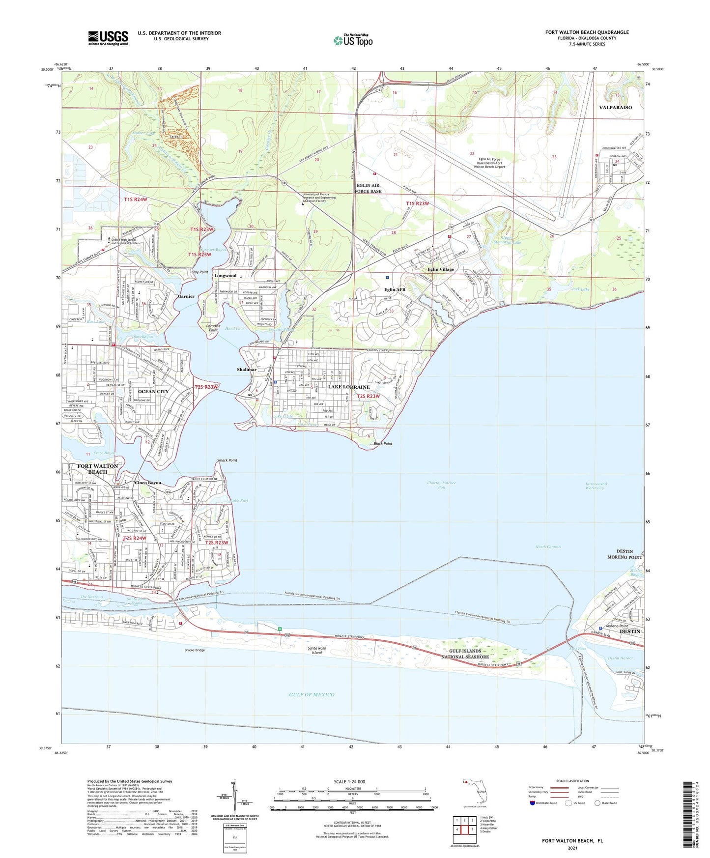
2025 topographic map quadrangle Fort Walton Beach in the state of Florida. Scale: 1:24000. Based on the newly updated USGS 7.5' US Topo map series, this map is in the following counties: Okaloosa. The map contains contour data, water features, and other items you are used to seeing on USGS maps, but also has updated roads and other features. This is the next generation of topographic maps. Printed on high-quality waterproof paper with UV fade-resistant inks.
Quads adjacent to this one:
West: Mary Esther
Northwest: Holt SW
North: Valparaiso
Northeast: Niceville
East: Destin
This map covers the same area as the classic USGS quad with code o30086d5.
Contains the following named places: Bass Lake, Bear Creek, Bel-Air Shopping Center, Beltway Shopping Center, Bens Lake, Black Point, Brooks Bridge, Camp Pinchot, Cherokee Elementary School, Choctawatchee Bay Entrance, Choctawhatchee High School, Choice High School and Technical Center, Chula Vista Bayou, Cinco Bayou, City of Fort Walton Beach, City of Valparaiso, Clay Point, Clifford Meigs Middle School, Dons Bayou, East Pass, Eastgate North Shopping Center, Eglin AFB Post Office, Eglin Air Force Base Census Designated Place, Eglin Air Force Base Fire Station 1, Eglin Air Force Base Fire Station 2, Eglin Air Force Base Fire Station 3, Eglin Air Force Base/Destin-Fort Walton Beach Airport, Eglin Village, Elliott Point Elementary School, Federal Bureau of Investigation - Fort Walton Beach Resident Agency, Ferry Pass Plaza, Fort Walton Beach, Fort Walton Beach Fire Department Station 6, Fort Walton Beach Fire Department Station 7, Fort Walton Beach Hospital Extended Care, Fort Walton Beach Park, Fort Walton Beach Police Department, Fort Walton Beach Post Office, Fort Walton Beach Public Library, Fort Walton Mound, Fort Walton Square, Garmier Bayou, Garnier, Garnier Creek, Hand Cove, Henderson Beach State Recreation Area, HSA Gulf Coast Hospital, Jack Lake, Jet Stadium, Kenwood Elementary School, Lake Clyde, Lake Earl, Lake Lorraine, Lake Lorraine Census Designated Place, Lake Vivian, Lightwood Knot Creek, Longwood, Longwood Elementary School, Lower Memorial Lake, Mariner Plaza, Marler Bayou, Miracle Mart, Moreno Point, North Channel, Northgate Shopping Center, Oak Hill School, Ocean City, Ocean City - Wright Fire District Station 1, Ocean City - Wright Fire District Station 2, Ocean City Census Designated Place, Ocean City Elementary School, Okaloosa County Emergency Medical Services, Okaloosa County Emergency Medical Services Station 9, Okaloosa County Sheriff's Office, Okaloosa County Sheriff's Office Central District, Okaloosa County Sheriff's Office Destin Substation, Okaloosa Island Fire Department Station 4, Paradise Point, Parkway Plaza, Poquito Bayou, Saint Marys School, Shalimar, Shalimar Elementary School, Shalimar Police Department, Shalimar Post Office, Smack Point, Sun Plaza, Timber Lake, Town of Cinco Bayou, Town of Shalimar, Towncrest Shopping Center, United States Air Force Eglin Regional Hospital, Upper Memorial Lake, W C Pryor Middle School, West Branch Lightwood Knot Creek, WFGX-TV (Fort Walton Beach), WPSM-FM (Fort Walton Beach), WYZB-FM (Mary Esther), ZIP Codes: 32542, 32579, 32580