MyTopo
Holt SW Florida US Topo Map
Couldn't load pickup availability
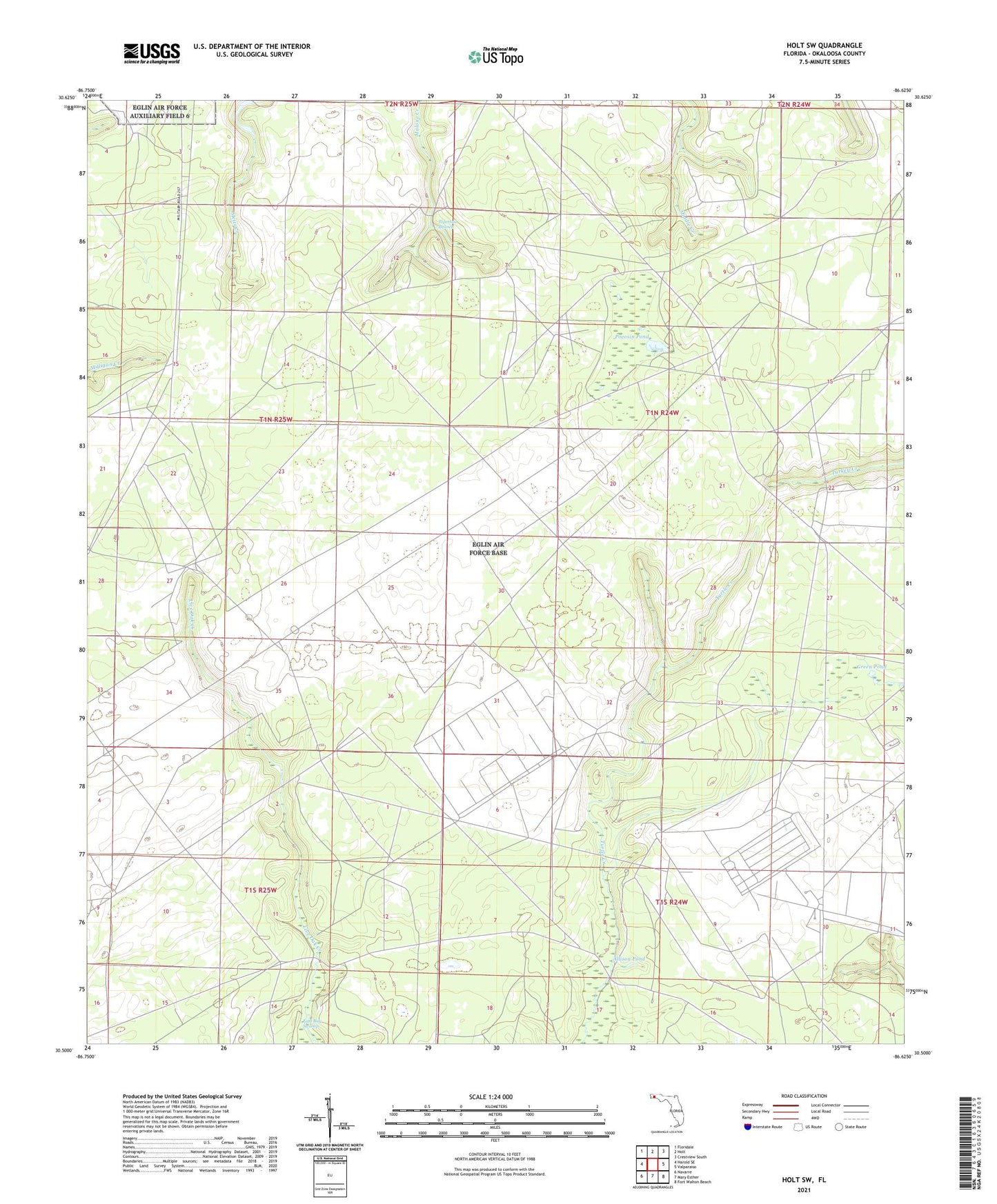
2024 topographic map quadrangle Holt SW in the state of Florida. Scale: 1:24000. Based on the newly updated USGS 7.5' US Topo map series, this map is in the following counties: Okaloosa. The map contains contour data, water features, and other items you are used to seeing on USGS maps, but also has updated roads and other features. This is the next generation of topographic maps. Printed on high-quality waterproof paper with UV fade-resistant inks.
Quads adjacent to this one:
West: Harold SE
Northwest: Floridale
North: Holt
Northeast: Crestview South
East: Valparaiso
Southeast: Fort Walton Beach
South: Mary Esther
Southwest: Navarre
This map covers the same area as the classic USGS quad with code o30086e6.
Contains the following named places: Allison Pond, Green Pond, Pocosin Pond