MyTopo
Destin Florida US Topo Map
Couldn't load pickup availability
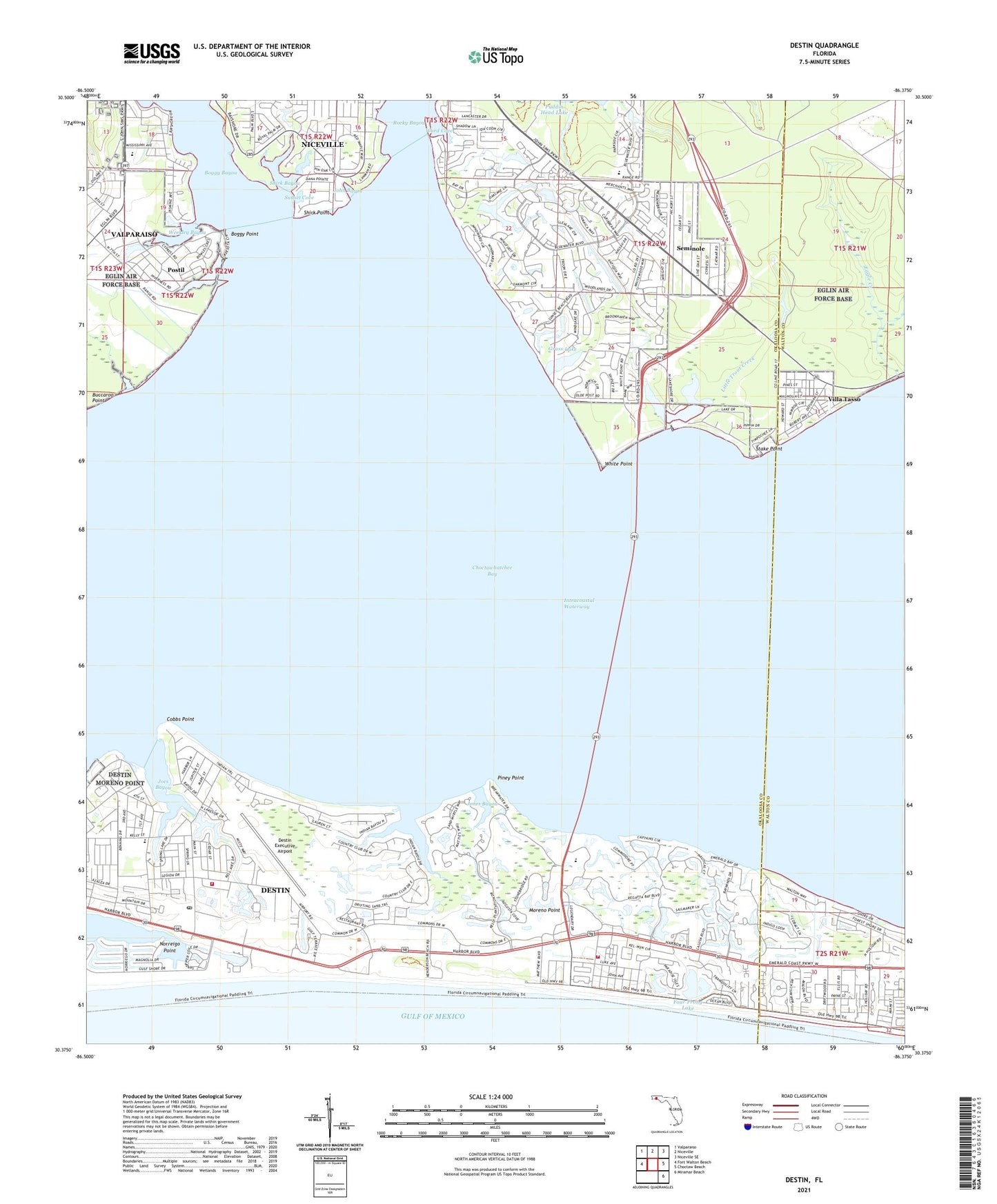
2025 topographic map quadrangle Destin in the state of Florida. Scale: 1:24000. Based on the newly updated USGS 7.5' US Topo map series, this map is in the following counties: Okaloosa, Walton. The map contains contour data, water features, and other items you are used to seeing on USGS maps, but also has updated roads and other features. This is the next generation of topographic maps. Printed on high-quality waterproof paper with UV fade-resistant inks.
Quads adjacent to this one:
West: Fort Walton Beach
Northwest: Valparaiso
North: Niceville
Northeast: Niceville SE
East: Choctaw Beach
Southeast: Miramar Beach
This map covers the same area as the classic USGS quad with code o30086d4.
Contains the following named places: Addie R Lewis School, Boggy Point, Buccaroo Point, City of Destin, Cobbs Point, Dana Point, Destin, Destin Elementary School, Destin Executive Airport, Destin Fire Control District Headquarters Station 9, Destin Fire Control District Station 10, Destin Harbor, Destin Post Office, Eagle Creek, Four Prong Lake, Fred Gannon Rocky Bayou State Recreation Area, Grass Lake, Indian Bayou, Joes Bayou, John Bayou, Jones Bayou, Little Trout Creek, Moreno Plaza, Moreno Point, Niceville-Valparaiso Division, Norreigo Point, North Bay Fire Control District, Okaloosa County Emergency Medical Services Station 10, Okaloosa County Emergency Medical Services Station 2, Palmetto Plaza, Parkway Church, Piney Point, Pippin Lake, Postil, Puddin Head Lake, Seminole, Shirk Bayou, Shirk Point, Shoreline Village Mall, Stake Point, Sunset Cove, The Shores Shopping Center, Villa Tasso, Ward Cove, WAWD-TV (Fort Walton Beach), Weekley Bayou, Weekley Pond, White Point, WMMK-FM (Destin), ZIP Code: 32541