MyTopo
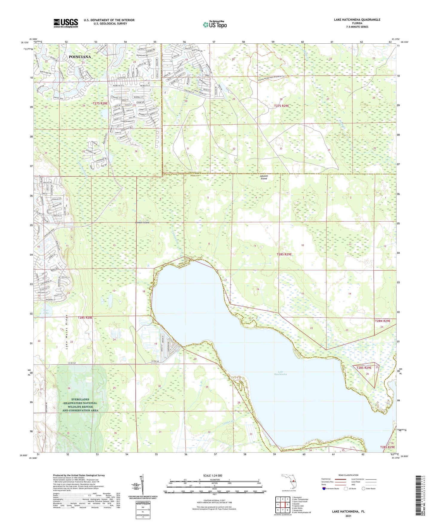
Lake Hatchineha Florida US Topo Map
Couldn't load pickup availability
2024 topographic map quadrangle Lake Hatchineha in the state of Florida. Scale: 1:24000. Based on the newly updated USGS 7.5' US Topo map series, this map is in the following counties: Polk, Osceola. The map contains contour data, water features, and other items you are used to seeing on USGS maps, but also has updated roads and other features. This is the next generation of topographic maps. Printed on high-quality waterproof paper with UV fade-resistant inks.
Quads adjacent to this one:
West: Dundee
Northwest: Davenport
North: Lake Tohopekaliga
Northeast: Saint Cloud South
East: Cypress Lake
Southeast: Lake Weohyakapka NE
South: Hesperides
Southwest: Lake Wales
This map covers the same area as the classic USGS quad with code o28081a4.
Contains the following named places: Allen David Broussard Catfish Creek Preserve State Park, Catfish Creek, Deer Lake, Johnson Island, Lake Hatchineha, Lake Marion Creek, London Creek, London Island, Poinciana Census Designated Place, Walker Ranch-Private Airport, ZIP Code: 34759