MyTopo
Kenansville SE Florida US Topo Map
Couldn't load pickup availability
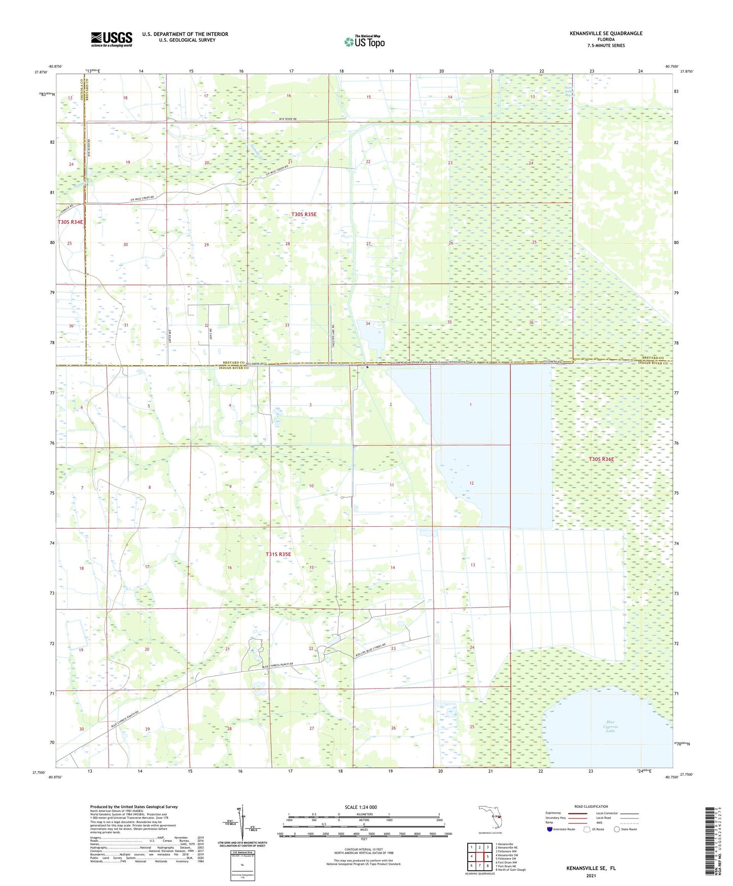
2024 topographic map quadrangle Kenansville SE in the state of Florida. Scale: 1:24000. Based on the newly updated USGS 7.5' US Topo map series, this map is in the following counties: Indian River, Brevard, Osceola. The map contains contour data, water features, and other items you are used to seeing on USGS maps, but also has updated roads and other features. This is the next generation of topographic maps. Printed on high-quality waterproof paper with UV fade-resistant inks.
Quads adjacent to this one:
West: Kenansville SW
Northwest: Kenansville
North: Kenansville NE
Northeast: Fellsmere NW
East: Fellsmere SW
Southeast: North of Gum Slough
South: Fort Drum NE
Southwest: Fort Drum NW
This map covers the same area as the classic USGS quad with code o27080g7.
Contains the following named places: Leonard Ranch, Mitchell Ranch, RLM Farms Airport, Sixmile Creek