MyTopo
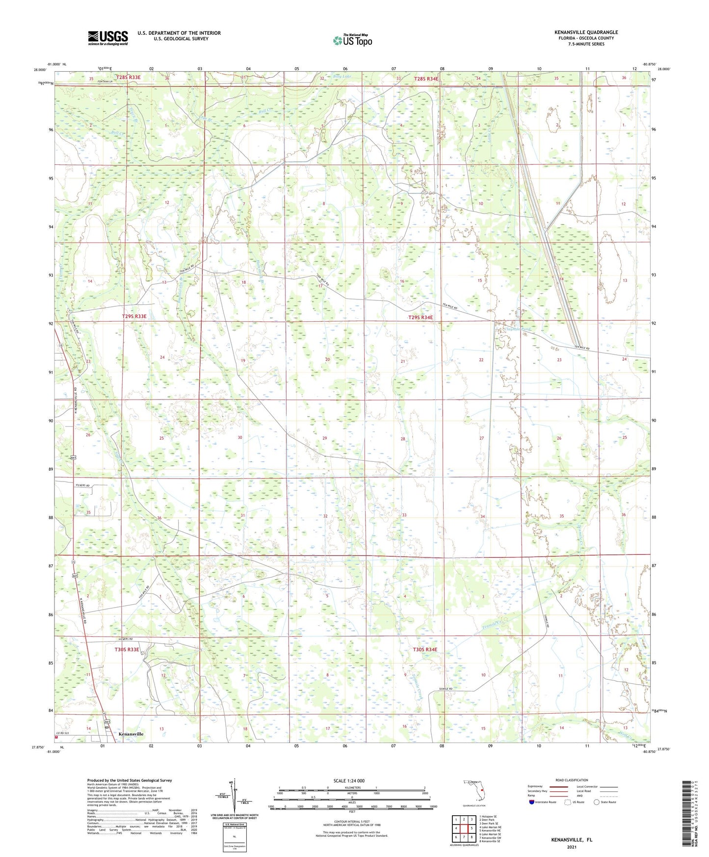
Kenansville Florida US Topo Map
Couldn't load pickup availability
2024 topographic map quadrangle Kenansville in the state of Florida. Scale: 1:24000. Based on the newly updated USGS 7.5' US Topo map series, this map is in the following counties: Osceola. The map contains contour data, water features, and other items you are used to seeing on USGS maps, but also has updated roads and other features. This is the next generation of topographic maps. Printed on high-quality waterproof paper with UV fade-resistant inks.
Quads adjacent to this one:
West: Lake Marian NE
Northwest: Holopaw SE
North: Deer Park
Northeast: Deer Park SE
East: Kenansville NE
Southeast: Kenansville SE
South: Kenansville SW
Southwest: Lake Marian SE
This map covers the same area as the classic USGS quad with code o27080h8.
Contains the following named places: Clayhole Pond, Gap Creek, Hammock Branch, Kenansville, Kenansville Post Office, Osceola County Fire Rescue and Emergency Medical Services Department Station 57, Pagett Branch, Rauslerson Branch, Tracy Branch, Tyson Creek, Yoke Branch